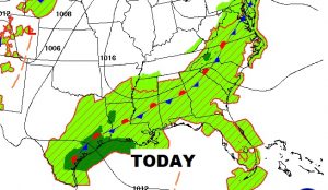
Good Morning, on a very busy Tuesday morning. I’ll cover a lot for you this morning on your video. Some of you had some very heavy rainfall totals yesterday. The front is still “parked” right on top of us, and Future Radar today is active. I have the updated rain chances for the rest of the week and through the weekend. Extremely Dangerous Hurricane Florence is aiming for the Carolinas. I have the latest from the Hurricane Center, and we’ll look Florence’s in direct on our forecast. The tropics are very busy. We’ll look at Isaac heading for the Caribbean. And, could we see a Depression or Tropical Storm in the Gulf before this week is over? Quite possibly. I’ll show you the track, on your Tuesday morning personal weather briefing.
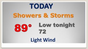
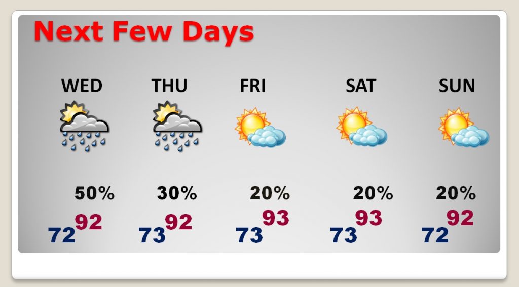
That front parked right over the state will be the catalyst for scattered to numerous storms again today.
Our rain chances decrease rapidly especially by Friday through Sunday. This is an in direct effect from Hurricane Florence over the Carolinas.
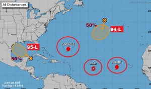
The tropics are crazy busy with 2 hurricanes, a tropical storms and two Invests.
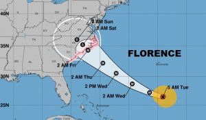
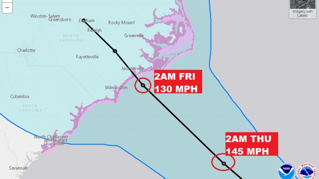
Florence is an extremely dangerous 140 mph Category 4 hurricane aiming at the Carolina. Landfall by Thursday night or early Friday. Hurricane watch from about Charleston to near Norfolk.
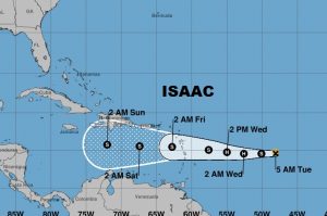
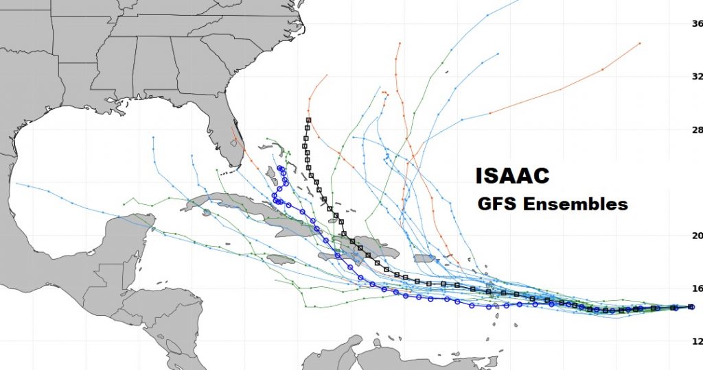
Tropical Storm Isaac could be a hurricane again as it nears the Caribbean Islands. Isaac’s long term future is unknown. It’s a head scratcher.
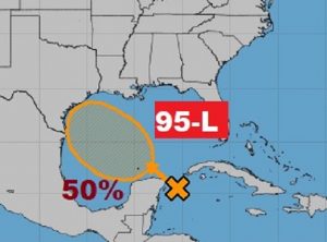
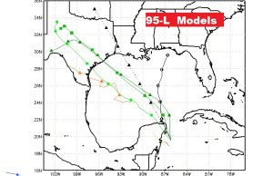
Invest 95-L is heading for the Gulf. It has a decent chance of becoming a depression or Tropical storm later this week. Most models take this system toward Texas. We’re watching because it’s in our backyard.