
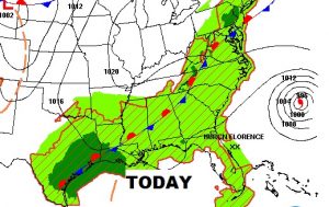
Good Morning! The fears and danger are growing along the Southeast US coastline, as Extremely Dangerous Florence aims for landfall on the Carolina coast. The models are doing some pretty crazy things to the Florence track after landfall, as the storm “hangs around” for a few days. What affect could the storm have on Alabama’s weather? And, what about Invest 95-L. Could we see a Depression or a Tropical Storm in the Gulf? I’ll bring you up to date with the very latest from NHC on your Wednesday morning weather briefing.
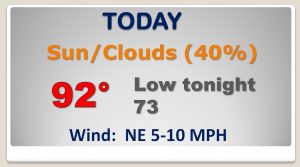
Stalled front brings more showers to the area today…hit or miss..
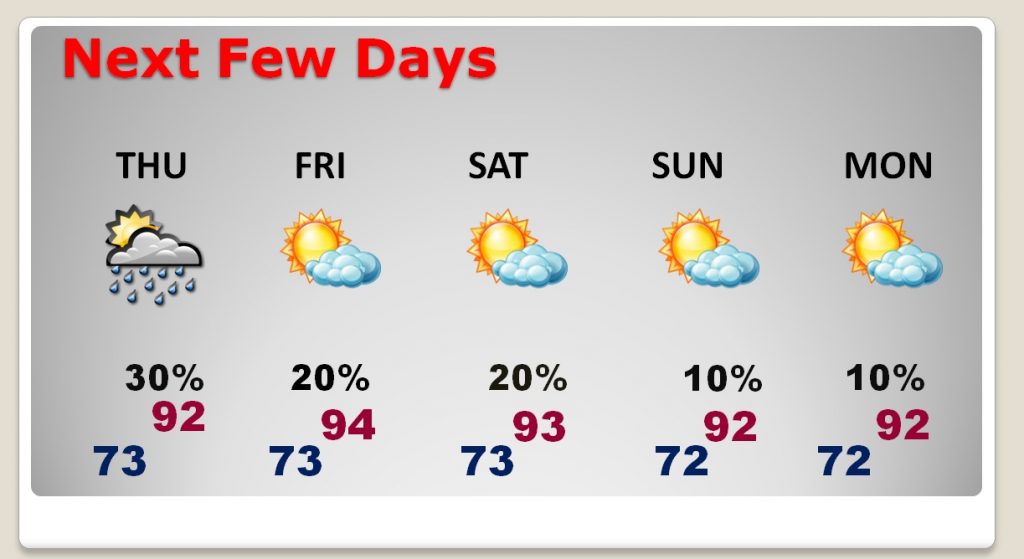
Rain chances thin out dramatically Friday through Monday. Future erratic course of Florence needs to be watched, though.
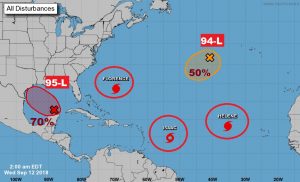
The tropics are very busy…
Florence winds are fluctuating. Now at 130 mph, but expected to increase later today and tonight. Hurricane Warning continues on the Carolina coast.
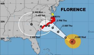
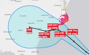
Crazy what could happen to Florence when it nears the coast and loses steering currents. It could hang around for days near the coast before drifting erratically southwest into Georgia. The cone of uncertainty now covers east Alabama. CRAZY…
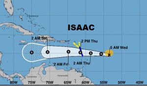
Don’t worry about Isaac. It will encounter wind sheer in the Caribbean and then start to fizzle.
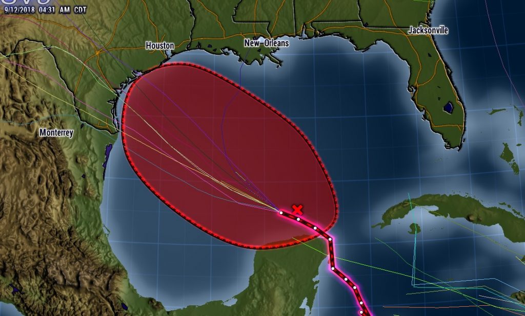
Invest 95-L will now LIKELY develop into a Depression or Tropical Storm and most likely head toward Texas. It needs to be watched.
.