1PM UPDATE: BREAKING NEWS: #TD14 upgraded to Tropical Storm #Michael. Headed for the Gulf, Michael is expected to be a category 1 hurricane at landfall Wednesday. Air force RECON is in the system now.
https://www.nhc.noaa.gov/text/refresh/MIATCPAT4+shtml/071743.shtml?
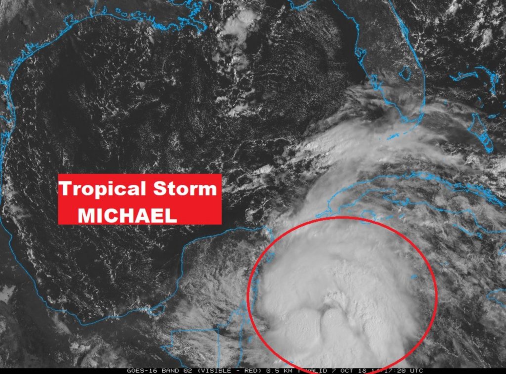
Tropical events are evolving quickly. Tropical Depression 14 has formed near the Yucatan, and will be moving into the Gulf today and become Tropical Storm Michael and potentially a hurricane before it makes landfall on the Gulf coast in only 3 days. On this special video, I’ll have the latest forecast cone from the National Hurricane Center. All of us are in the “cone of uncertainty” on this storm. We’ll look at the track, the timing and the intensity and talk about potential impacts. And, get ready. After Michael, then cool front we’ve been waiting for arrives.
Events will move quickly. Tropical Depression 14 could be a Category one Hurricane Michael, perhaps making landfall Wednesday along the northern Gulf coast.
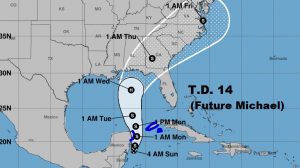
A Close up of the NHC cone: Most of Alabama is in the cone of uncertainty. Don’t focus on the center line. It could shift west or east.
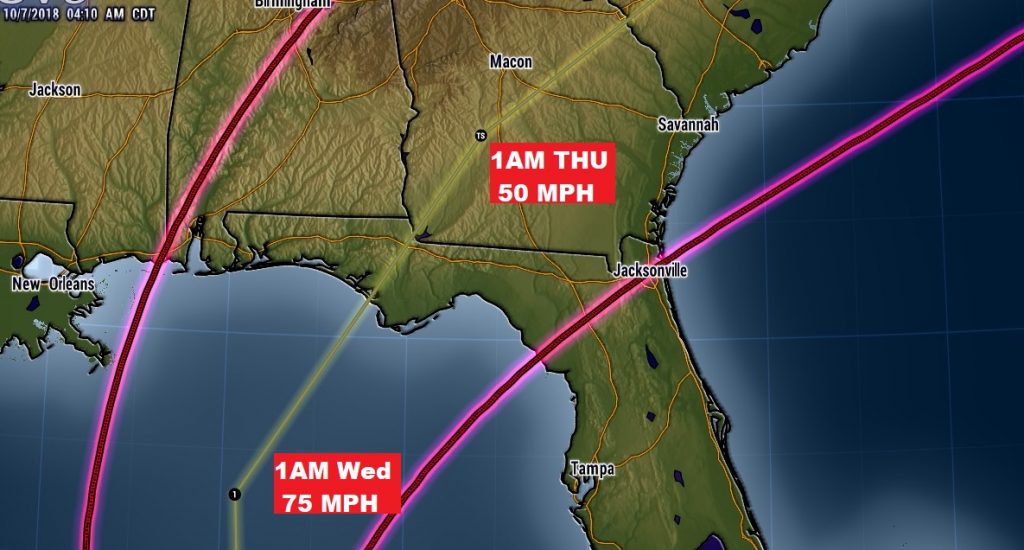
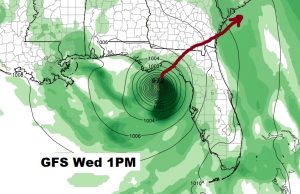
The GFS is the fastest on arrival time. It has the system arriving Mid day Wednesday. The NHC forecast is close to this time line.
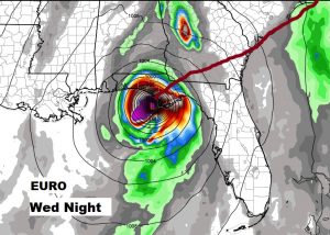
The Euro is slowest on time line. It has arrival on the coast late Wednesday night or early Thursday.
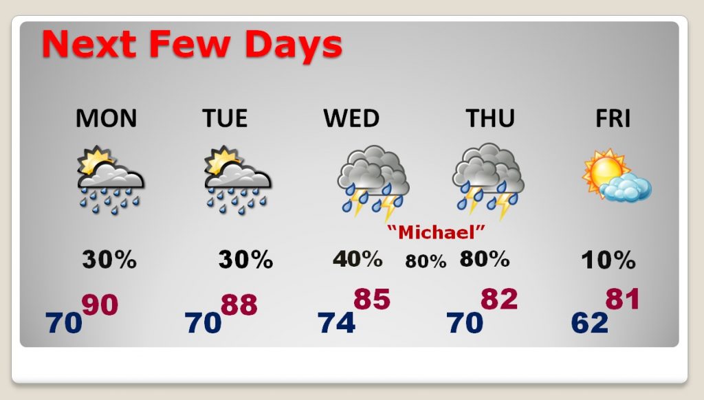
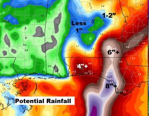
Here’s a very early guess on potential rainfall. Maybe 6″+ in the Wiregrass counties, depending on the track.
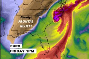
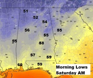
Then get ready for the cool front we’ve been waiting for. It arrives at the hurricane exits. Cooler drier air starts to filter in Thursday night and Friday. We could have a low in the upper 50’s by Saturday morning.
Spotty storms return Monday and Tuesday. Then the rain chances ramp up Wednesday and especially Wednesday night into Thursday with the approach of Michael.