
Good Morning! The “coolness” that we enjoyed for a couple of days is fading for now. The nights are warmer, and afternoon highs are back in the 80’s for the next three days. The risk of showers will be back on the weather menu tomorrow through mid week, as another cool front approaches. The seventies will be back later this week.
TODAY: Sunshine will dominate. Light southeast wind 4 to 8 mph. High today 85. Tonight’s low 55. Dry today.
Great weather at Talladega today! Picture-postcard forecast.

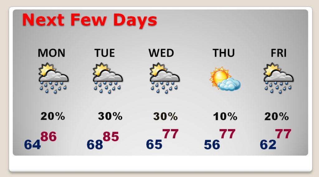
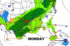
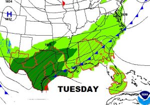
NEXT FEW DAYS: Monday and Tuesday, with highs in the 80’s, the risk of a few showers will be back, as a cool frontal system approaches. We should be back to the 70’s by late week, with cooler nights in the 50’s. Risk of showers will increase again by Friday and over the weekend.
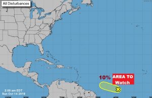
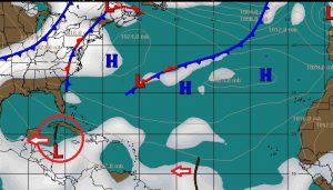
ARE WE DONE WITH THE TROPICS?: There are no names on the map today. There is one area to watch in the tropical Atlantic, and on the surface map we see a tropical wave in the western Caribbean. But, for now, the tropics are as quiet as a mouse. This is very unlike last Sunday when Invest 91-L became a Depression then Tropical Storm and later Hurricane Michael. It’s still surreal to think about how quickly Michael blew up, and intensified, and became one of the most intense 3 or 4 hurricanes to strike the US coastline in history.
CLIMATE DATA: Saturday’s morning low was 54, afternoon high 81. Normals: 55 and 79. Sunrise this morning is 6:48. Sunset at 6:13.
—
Have a great Sunday! I am back in Montgomery now. I will have you a complete video update Monday morning online by 4:45AM.
Rich