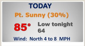
Good Morning! After two days with a high of 89, we’ll back in the 80’s again today. But, hang on, some frontal relief is on the way. Some of us could see some showers with that front. I’ll show you some cooler days and nights on the way. That’s the first of two fronts this week. A more important front is on the horizon for this weekend. Wait till you see what that will do to our temperatures. Lots of good information on your Tuesday morning personal weather briefing.
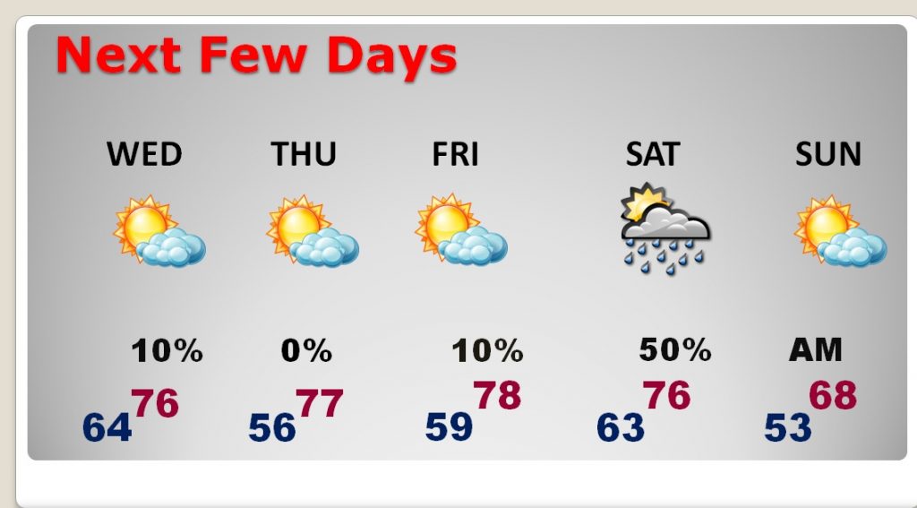
We are back in the 80’s again today, but a cool front moving through the state will bring a risk of showers today and then somewhat cooler air tomorrow as we return to the 70’s for highs and 50’s at night.
The next frontal system arriving sometime Saturday night will bring in the coolest air of the season so far, The global models are roughly 6 hours apart of the frontal arrival time.
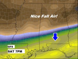
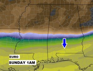
Highs till fall back to the 70’s for the rest of the week, starting tomorrow, with a couple of mornings in the 50’s. That next cold frontal approaching will bring in a good chance of showers and storms Saturday before much cooler air funnels in behind the front Sunday.
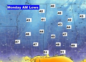
This looks nice! Projected morning lows on Monday morning around Dawn.