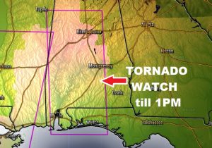
TORNADO WATCH till 1PM as far east as Elmore, Autauga, Crenshaw and Montgomery counties.
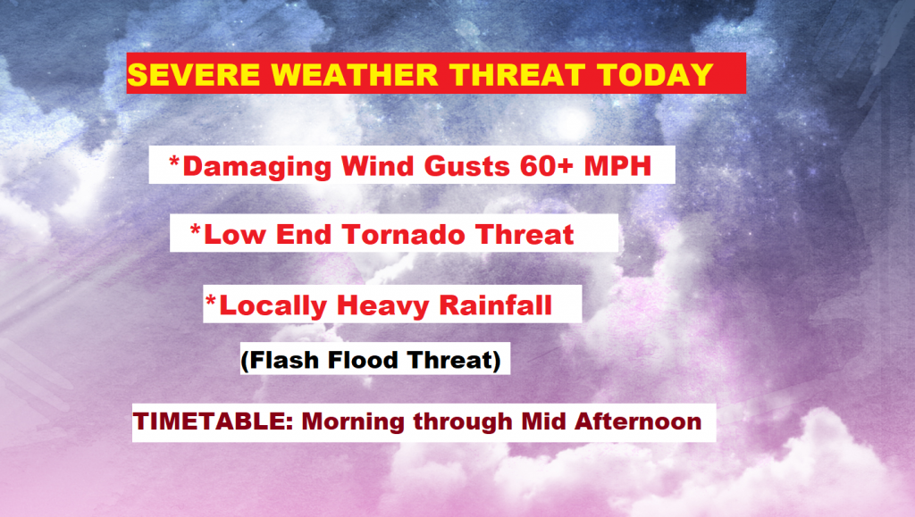
…SEVERE WEATHER THREAT TODAY… A Potent cold front will sweep across the state today with a round of severe thunderstorms, producing damaging wind gusts, heavy rain, and tornadoes can’t be ruled out. On this video, I have the latest on timing, the updated threat level from the Storm Prediction Center, and the expected impacts that we can expect, including rainfall totals. Sharply cooler air follows the front. I have the latest on what to expect for the weekend. Plus, another front will greet us as the new week begins. There is a lot important information I’ll cover for you on your Special Thursday Morning briefing.
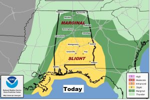
All of the state is under a severe weather risk today. The biggest threat is straight-line damaging thunderstorm winds, but there is also a low end tornado risk, especially in the areas highlighted in yellow across the southern half of the state.
Here’s a summary of the impacts expected by today’s severe weather risk.
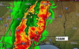
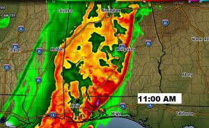
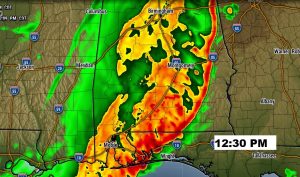
Here’s one model idea on possible timing. Don’t take the times and positions literally, this is just one possible solution.
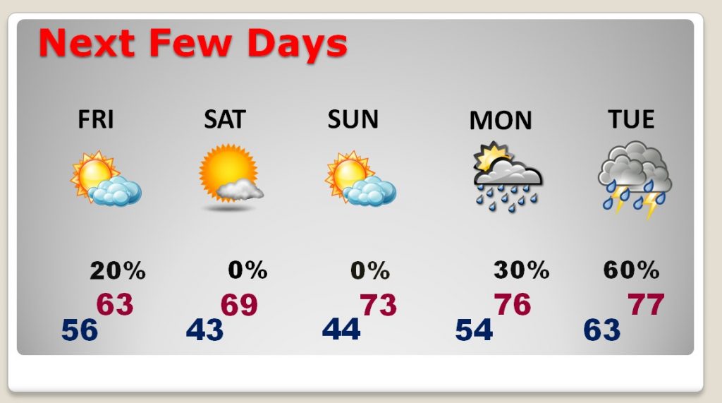
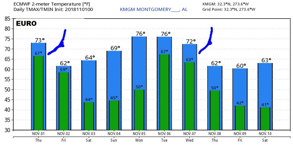
After the cold front, Friday will be breezy and sharply cooler. Coldest mornings will be Saturday and Sunday around Dawn. Then look for temperatures to modify back to the 70’s Another approaching front brings more showers & storms to the state on Monday and Tuesday.