Good Morning! Many changes ahead. There is good news about a big warm-up, which begins today, and continues through the weekend. But, we have our eyes on the next storm system which could bring a round of severe weather to our state on Saturday. On this video, I’ll walk you through the new model data. We’ll look at possible impacts and time line. And, our temperature roller coaster is only beginning. I’ll show you when the next temperature plunge will arrive. I have some very good information to share on this morning’s important video.
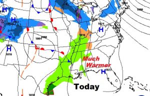
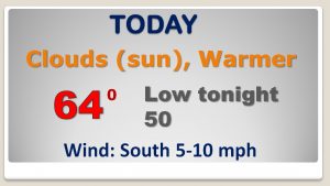
Cold start today leads to a MUCH warmer afternoon, finally! Today’s high in the mid 60’s is exactly normal for this time of year.
Ominous storm system approaching with a severe weather threat looming four our state on Saturday.
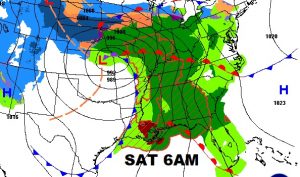
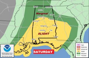
The Storm Prediction Center has all of Alabama in a Severe Risk Saturday, including a stage 2 risk in the yellow from Birmingham southward. Tornadoes can’t be ruled out.
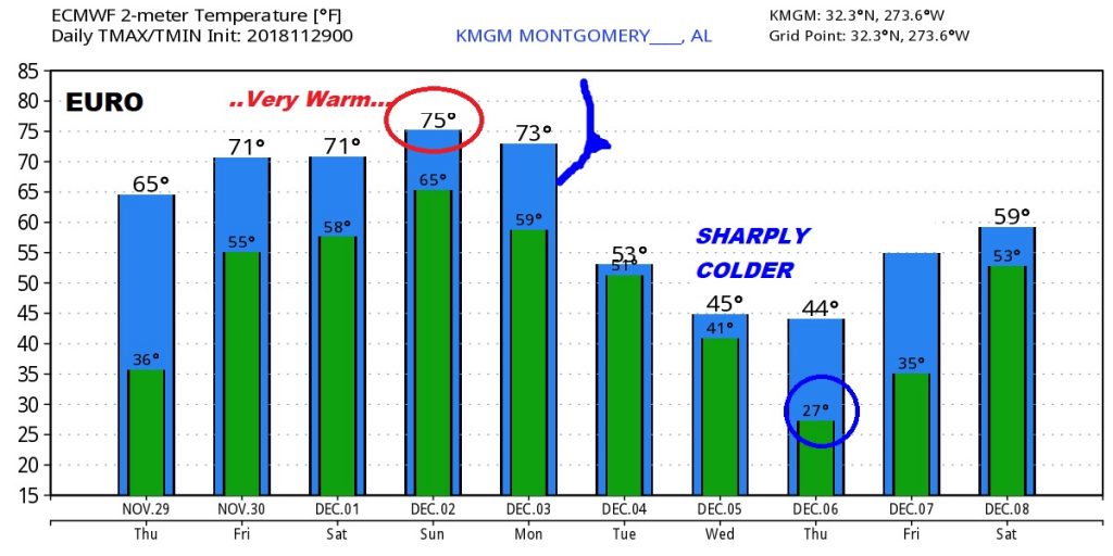
Dramatically warmer temperatures through the weekend, before a cold front arrives Tuesday morning with falling temperatures during the day Tuesday.
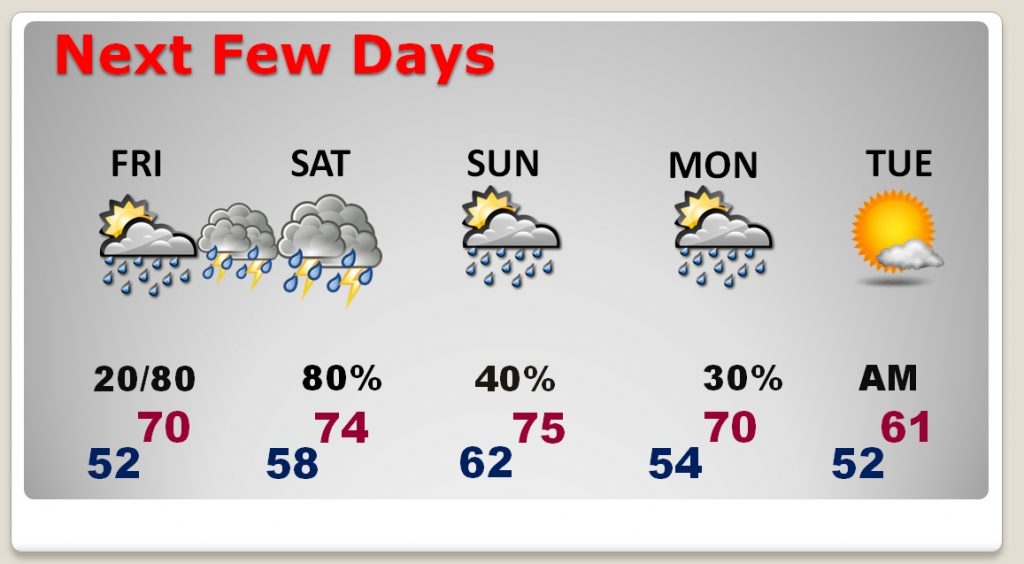
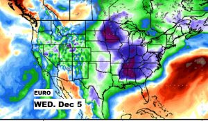
The EURO model shows the next dip on the Roller Coaster by the middle of next week. Drastically colder again.