
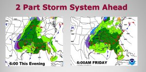
Get ready for some more weather changes as a two part storm system approaches the state. Expect some drenching rains from the first part by tonight and tomorrow morning (the surface system), and a lingering shower threat Friday & Friday night from part two (the upper level system). A few thunderstorms can’t be ruled out, but we are not expecting any severe weather here. There could even be a leftover shower or two Saturday.
Here’s set up for this evening and tomorrow morning, showing a multi-faceted storm system.
TODAY: Cloudy and mild today. We had a high of 61 yesterday..today I thick we’ll be near 60. I can’t rule out an afternoon shower in the area. Becoming breezy with east wind 10-15 today, gusting to 20-25+ tonight. Rain and perhaps a few thunderstorms are likely. Low tonight 53.
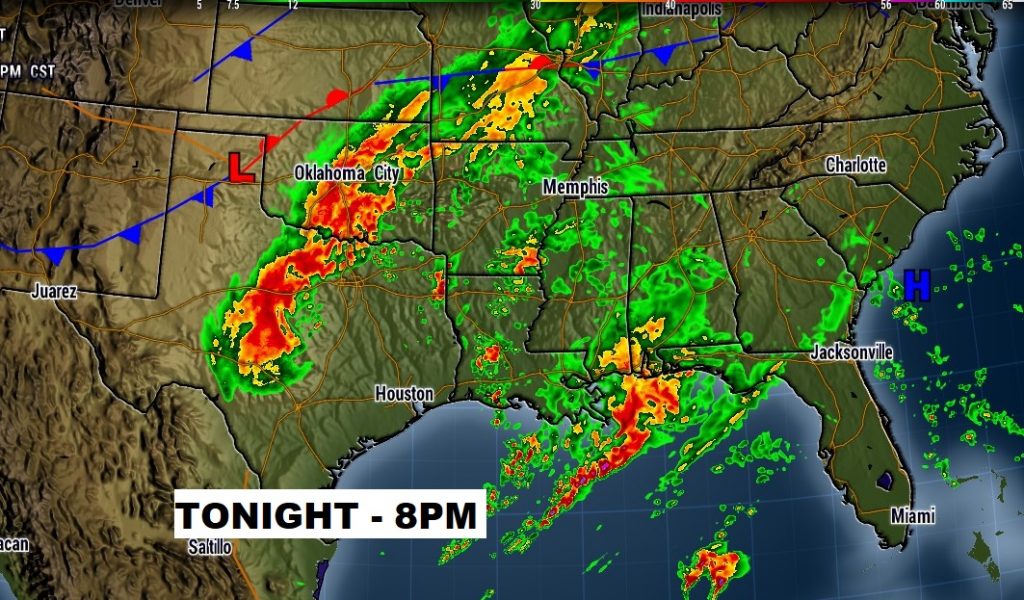
Here’s a snapshot of 8PM tonight clearing showing Part 1 on our door step, and Part 2 back in Texas, causing a little snow.
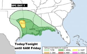
‘The Storm Prediction Center is highlighting a severe weather threat today from the ArkLaTex area eastward to the Alabama and NW Florida Gulf coast through 6am Friday.
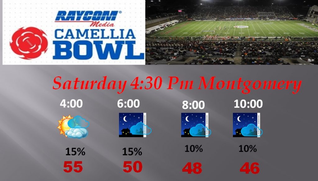
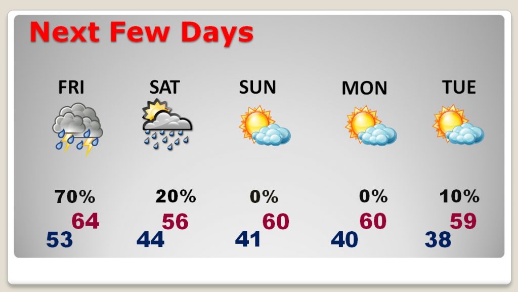
SATURDAY: There are many important events on the line. The list is long. Two of the biggest are Christmas on the Coosa and The Camellia Bowl. Although the rain chances are not zero, they are very small. There could be an isolated shower. Mostly cloudy. High in the upper 50’s.
THE NEXT FEW DAYS: After Saturday, the weather is looking pretty nice Sunday through Tuesday. Storm-free and very comfortable for December.
—
No video this morning due to the office Christmas party last night. (I slept a little longer). But, there WILL be a video online tomorrow morning at 4:45AM. We’ll take a closer look at that big pattern change next week, as Winter takes a break over the whole country. Will that pattern still be in place on Christmas Day? Join me in the morning. Have a great day today.
Rich