
Sunshine makes a big return today! After a damp, windy & cold Friday, temperatures will make a nice recovery, with far less wind. In fact, we’ll even be warmer tomorrow as highs reach the 60’s While there could be a stray shower or two Sunday, the forecast through Christmas will be storm-free, and pretty nice. But, a significant storm system could be a headache for travelers heading home after the holiday.
TODAY: After a chilly morning, sunshine should help boost temperatures close to the upper 50’s this afternoon, which is exactly normal. Winds will be much lighter – westerly at 5-11 mph. Low tonight 38.
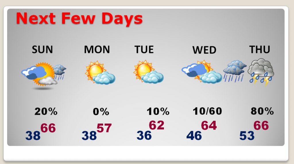
NEXT FEW DAYS: Sunday will be mild with highs in the mid 60’s A weak cool front could touch off a couple of isolated showers. Otherwise we should be dry through Christmas Day. I have adjusted the highs and lows downward just a bit.
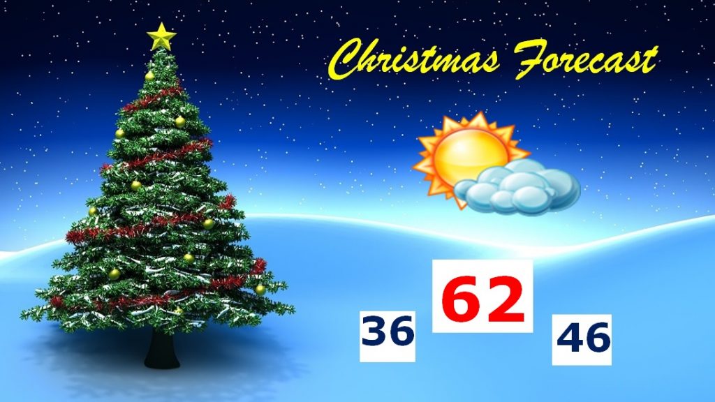
CHRISTMAS FORECAST: We’ve had all kinds of wild Christmas day weather from hot to cold, flooding, and tornadoes. This year, however will be rather quiet and rather nice, for a change.
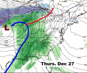
POST-CHRISTMAS: Just a heads up. We’ll be dealing with a big deal storm system Christmas week. The best chance of showers and storms will begin some Wednesday night and continue through the end of the week. The main threat will be heavy rainfall. A few thunderstorms area also possible. Fortunately, no ice or snow will be involved. Right now, no severe weather is expected, but this storm system will have a major impact on holiday travel.
– –
I’ll keep you up to date with any changes throughout Christmas weekend. Have a great Saturday! Enjoy the sunshine. Merry Christmas
Rich