Good Morning on a chilly Christmas Eve Morning! I’ll update you on the holiday forecast details, but we’ll also look ahead to a rather big post-Christmas storm system which affect Holiday Travel for many, and bring potentially very rain totals to Alabama. I’ll show you how much rain could fall, and how long the storm system may linger. It could be around for several days.
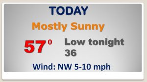
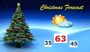
Cool sunshine but a nice day today. It’ll be a day much like Saturday, with highs in the upper 50’s. The Christmas forecast is shaping up nice. Chill start in the mid 30s around Dawn, but a nice recovery to a high around 63, The low Christmas night will be in the mid 40’s.
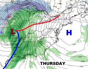
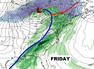
We are dry through Wednesday, but the rain risk begins late Wednesday night, and the rain threat continues perhaps through most of the New Years weekend.
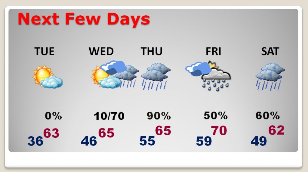
This massive post Christmas storm system will not only drench us, it will have wide ranging implications for holiday travelers for the entire eastern half of the nation.
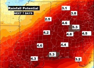
Drenching rains are expected here. In fact, this map is rather conservative compared to other model forecasts. Many spots could see 4-5″ in the next 7 days.
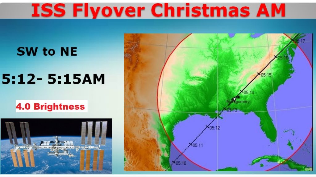
ATTENTION SANTA: Excellent very bright Space Station Flyover, extremely early Christmas morning well before dawn.