
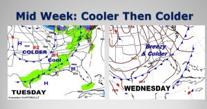
It should be a textbook-perfect Sunday. Rarely do we see a day this nice in January. With highs in the upper 60’s today and lower 70’s on Monday & Tuesday, this is just what the doctor ordered. Changes are in store by midweek. The first of two cold fronts arrives Tuesday. Stage two of the colder air sweeps across the area on Wednesday. This very chilly set-back will be around for about three days.
Here’s today’s map. Do you see the letter “H”. That stands for high pressure. Should be a beautiful travel day around the South.
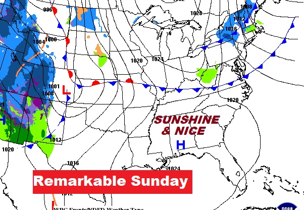
TODAY: Nearly total sunshine. After a cool start, should be a comfortable day. High in the upper 60’s. (average high 57, Low 36) Wind will be light. Clear and cool, low 44 tonight. Enjoy!
COLDER BY MID WEEK: The Tuesday cool front will deliver the first shot of cooler air. A second cold front arrives Wednesday with stage two of the colder air, on gusty north winds. Coldest morning and day will be Thursday.
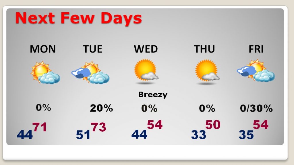
NEXT FEW DAYS: The warmest days will be Monday and Tuesday, with highs 70+. The rain chance, as the front arrives Tuesday will be small, only about 20%. Windy and colder Wednesday. We’ll be close to freezing Thursday morning, with a high barely up to 50. Chance of showers again Friday night into the weekend as the next storm system approaches.
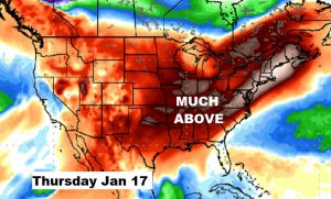
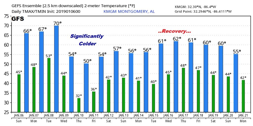
LONGER RANGE OUTLOOK: Our chilly mid-week Colder Set-back will apparently only last for about 3 days. Look at the following week. The EURO model suggests that much above normal temperatures will dominate much of the nation. Still no signs, over the next two weeks, that the arctic flood gates will open, with a significant dose of winter air. We continue to monitor the distant horizon.
Here’s the GFS raw model temperature guidance for the next 16 days. Don’t focus on the specific numbers. We’re just looking at trends here.
—
Have a great Sunday! I’ll have a complete video update Monday morning at 4:45AM. Enjoy this beautiful weather!
Rich