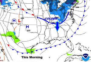
Good Morning! We have been very spoiled over the last few days, but reality is setting in. Spring-like air is history. Get ready for some much cooler days and colder nights. We’re headed for e couple of freezing nights, in fact. What’s next? I’ll show you how the next storm system could affect your weekend plans. And, where is the true Winter Air…and when could we see it in this part of the world? Again, this morning, we’ll climb to the mountain top and look at the distant horizon, on your Wednesday morning personal weather briefing.
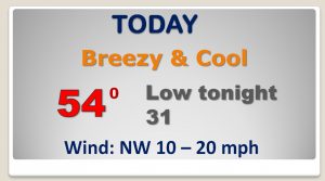
Instead of 74 today, how about 54 degrees with a stiff breeze that will make it seem colder. Tonight will be the first freeze of the New Year. Last freeze was Christmas Day.
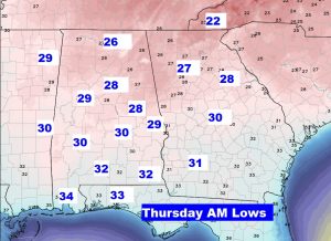
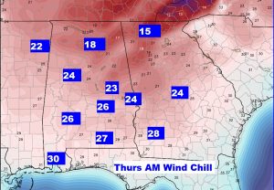
At Dawn temps will range from upper 20’s around Lake Martin and Auburn to near 32 in Dothan. Wind chill will be in the 20’s.
Very Chilly Thursday and Friday. Rain moves in Saturday until early Sunday. Chilly again Monday.
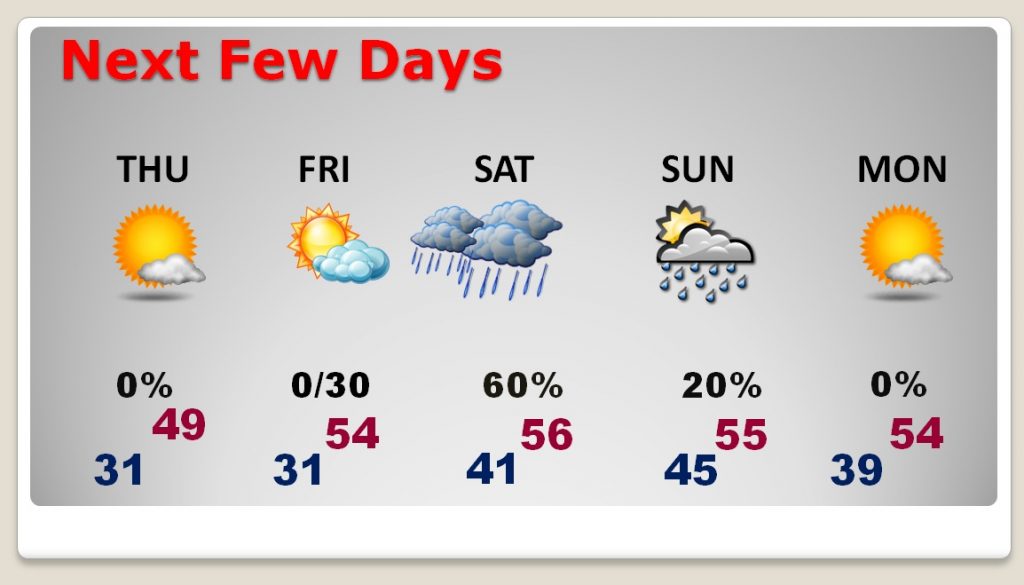
Rain dominates the forecast Saturday and Saturday night and early Sunday, before it turns colder again behind the storm.
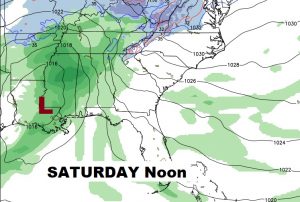
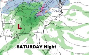
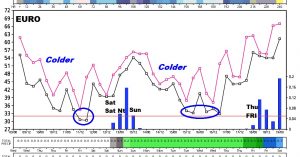
The Euro model shows are big cool down today and tomorrow. It shows the rain with the weekend storm system and then colder again, Another storm system late next week.