Good Morning! This is a good day to stay weather aware. We’ll be monitoring a line of storms through much of the day, from the morning, in the western counties through mid-afternoon, at least, in the southeastern counties. A few of the storms could be severe. I can’t rule out an isolated tornado or two. On this video, we’ll look at the details, and the time line. And, we’ll look ahead. Looks another front arrives on Friday. It’s an active pattern, with up to 4 fronts in the next seven days. Hope you have a chance to watch the video.
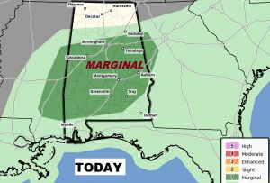
The Storm Prediction Center has a “Marginal” Severe Risk covering most of our area for today. Greatest risk window is from about 9AM in the west counties until about 2PM in southeast Alabama. Damaging wind gusts are possible and a brief tornado or two can’t be ruled out.
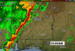
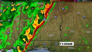
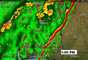
We’ll be monitoring a line of strong/severe storms crossing the state. Here’s one model’s idea on the possible time line. This may be an hour too quick…but this is just a general idea on how this could unfold.
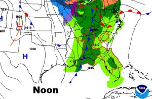
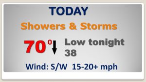
The front reaches central Alabama at Noon. High today around 70 around lunchtime, then windy and much cooler after the frontal passage, falling to the upper 30’s tonight.
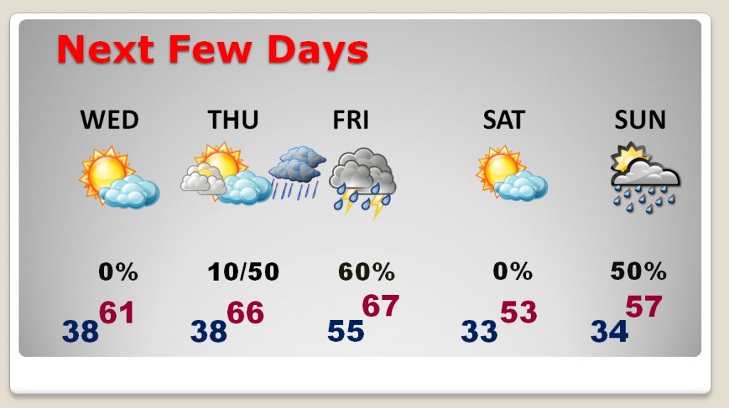
Wednesday and Thursday will be quiet. Another front Friday and yet another one perhaps Sunday.