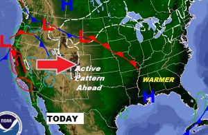
Good Morning! We have a nice day to look forward to, but get ready for a change. We are headed into a very active weather pattern for the next several days, as a parade of storm systems march across the Deep South through the next 7-10 days. Rain chances will escalate each day. Rainfall could be excessive in parts of our state. I’ll walk you through the details and I’ll show you how much rain we can expect.
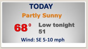
Nice Valentine’s Day, today, but get ready for an active pattern ahead, as a parade of storm systems move across the region next few days.
Showers will be very isolated Friday, but look for an escalating rain chance each day. starting this weekend and in through the middle of next week at least. Temperatures will be mild for February, but a little cooler Monday and Tuesday.

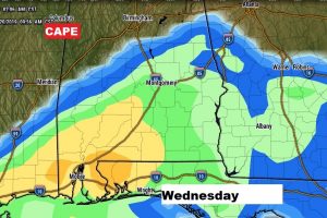
The next storm system, which could have the best potential for strong to severe storms in the next week will arrive around mid-week. Here’s the set-up next Wednesday. Too early to sero in on the threat, but it looks like some of the ingredients will be present.

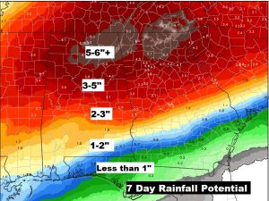
Rainfall totals across the south will be excessive in the next 7+ days. Perhaps 5-6″+ across parts of north Alabama and north Georgia.