Get ready. We are getting into a very active weather pattern. A string of storm systems are lined up between here and the west coast and beyond. It won’t rain all the time, but it will be wet at times for the next several days. Total rainfall across the south over the next several days could be excessive. On this video, I’ll walk you through the “up and down” rain chances through the weekend and into next week.
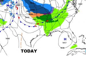
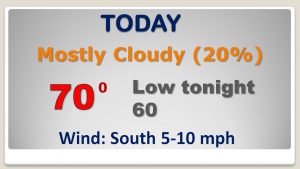
That front to the north of us will be like a train track over the next few days, as waves of low pressure move along the front, one after another, after another. Mild today and tonight.
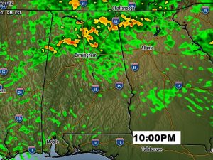
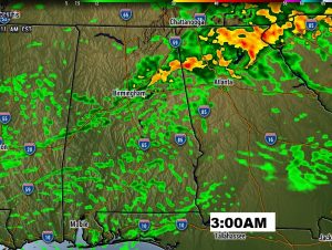
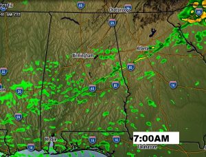
Future Radar shows how the rain chances ramp up overnight tonight and into the morning hours Saturday.
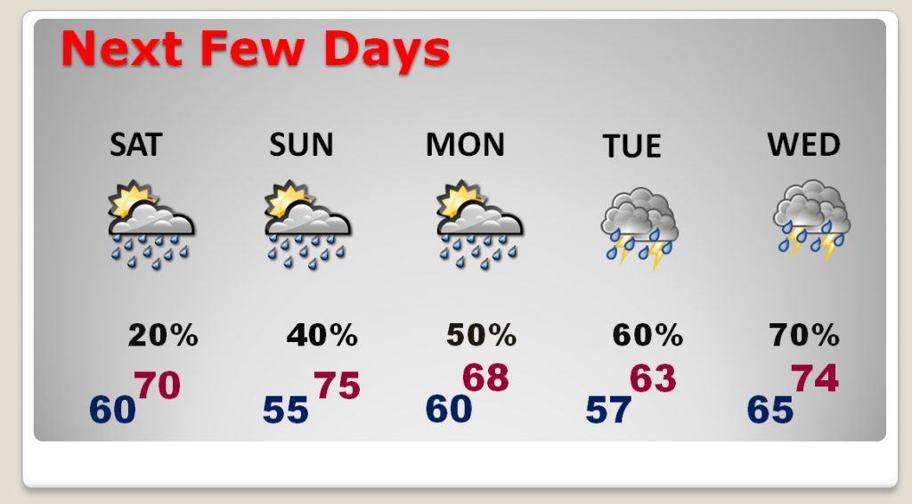
It’s not going to rain all the time, but the chance of rain is in the forecast every day…for the next several days. Notice how the rain chances seem to get a little better every day Sunday through Wednesday.
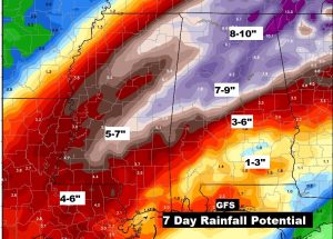
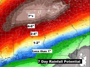
The biggest message of the next 7 days is the potential for prolific rainfall amounts across the south from Louisiana to the Carolina’s. This could become a serious situation, particularly across the Tennessee valley.
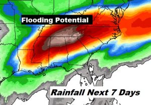
This is a conservative “model blend” rainfall potential forecast for the next several days. Potentially crazy amounts, especially in north Alabama and north Georgia.
The GFS model is even more excessive with the potential rainfall totals. Lets hope its wrong.