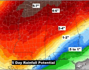
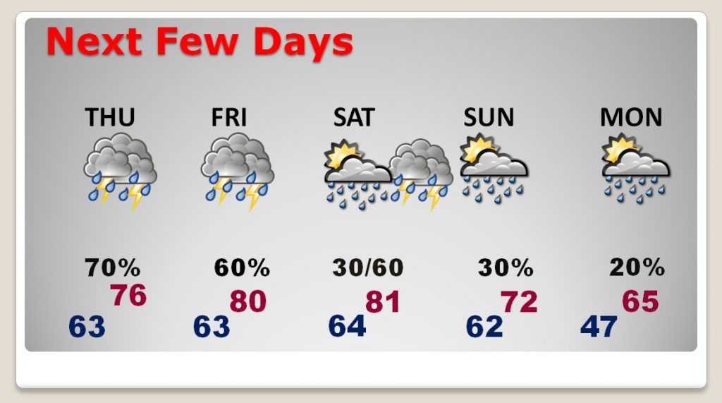
Good Morning! More rain for Alabama. Today some of the storms could be strong/severe in spots. I have the latest from the Storm Prediction Center. We have 4-5 more days with rain in the forecast, as a parade of storm systems line up. It appears the strongest system could arrive by Saturday evening. Severe storms area possibility, according to SPC. I’ll update the set-up and the time line. And there have been some adjustments to just how much more rainfall Alabama could see in the next few days.
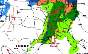
A northward moving warm-front will be a key player today, as big chunk of the state gets into “juicy” air, leading to the threat of strong/severe storms, perhaps even as far east as the I-65 corridor today. A brief tornado or two can’t be ruled out, along with strong gusty winds and the threat of hail.
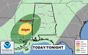
Rain continues in the forecast for the several days. Best chance of thunderstorms today through Saturday. Severe weather can’t be ruled out Saturday or Saturday night. We’re watching this system closely.
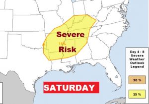
Potent storm system will begin to affect the state Saturday and Saturday night. Many of the ingredients for severe weather will be present. Tornadoes are also possible.
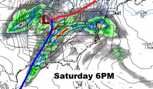
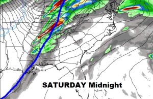
SPC has already highlighted much of Alabama for s severe weather risk Saturday PM.