Good Morning! We have a very Spring-like pattern on this last day of February. The next few days will be wet, and potentially stormy at times. I have the latest from the Storm Prediction Center on which areas could see severe weather. Drenching rains are in our future. I’ll show you the projected rainfall totals. And, are you ready for some Arctic Air? Get ready. We’ve been telling you about it for awhile. I have some new arrival time information and I’ll show you how daily highs could be 35 degrees colder, with mornings in the 20’s. What a change, soon…
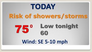
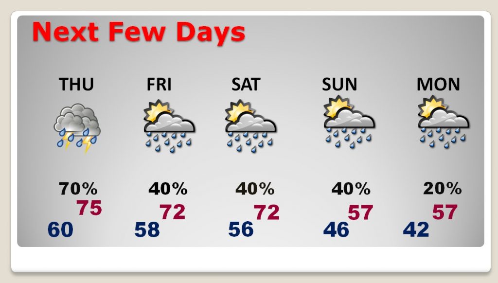
Wet at times today and tonight, with scattered showers & storms. Spring-like Highs in the mid 70’s.
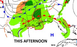
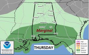
The set-up for tomorrow puts much of central and south Alabama in the “juicy air” with the threat of stronger storms. The Storm Prediction Center says a few storms could be severe from Montgomery southward.
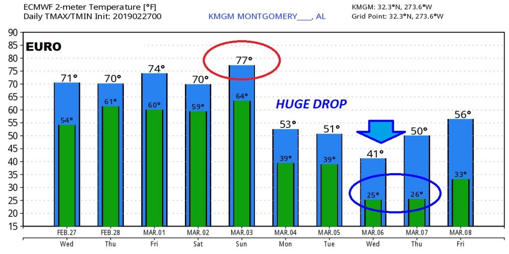
Wet at times through the weekend. Much cooler air starts to filter in by late Sunday into Monday.
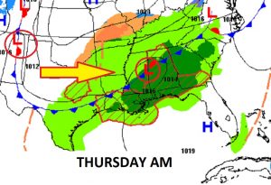
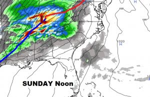
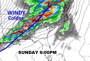
The set-up for Sunday is starting to look more concerning as a strong cold front approaches. Could turn into a potential severe weather threat situation. We’re watching.
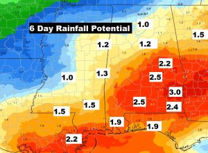
Drenching rains for much of central & south Alabama. 2-3″ in spots.
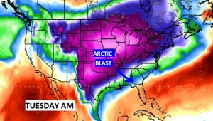
The second front, arriving Tuesday is an Arctic Cold Front . Dramatically colder by mid-week.
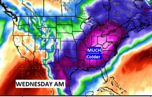
Look at the huge temperature drop the Euro model is showing next. Wow. That’s a BIG change…