Welcome to March! Looks like another wet commute for many this morning. On this video I’ll update you on the shower threat today and tomorrow, of course. But, we’ll take a closer look at a developing severe weather scenario for Sunday. The models do not agree on the details or the severity. I’ll show you what we know. And, are you ready for drastically colder air? Hang on. We are about to take a big plunge soon. I have the latest on timing and the new numbers on how cold.
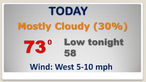
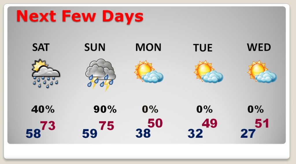
Risk of showers continues today, but by afternoon the showers will be spotty and mostly across south Alabama.
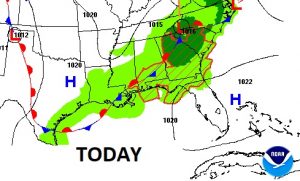
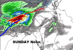
Potentially potent set-up Sunday. Low pressure tracks across north Alabama, dragging a cold front into the state. Strong to severe storms ahead of the front.
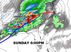
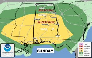
Sunday Severe Weather Risk from SPC: Level Two “Slight Risk” covers the southern 2/3 of Alabama. Severe with damaging wind gusts and the threat of tornadoes are the main risk. Quarter size hail also possible. Greatest time window would be from 10AM to 8PM.
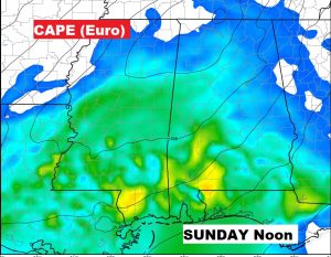
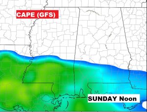
Models disagree on some of the severe weather elements for this storm situation. For instance, The Euro model is bullish on instability or CAPE, while the GFS model is least bullish on available instability.
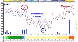
After the front which brings the storms, it turns windy and drastically colder Monday. We’ll be in the 20’s by Wednesday morning.
The EURO thumbnail shows the huge temperature drop from the 70’s Sunday to the 20’s Wednesday morning.