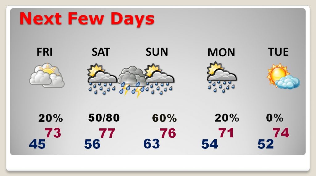
Good morning! It’s another freezing morning, but we are about to shift gears. The warm-up begins this afternoon. We’ll be in the 70’s over the weekend. But, attention shifts to another significant storm system approaching the state. Looks like a muliti-state severe weather outbreak, again. All of Alabama is in the severe weather threat beginning Saturday afternoon into Sunday. I have the latest from the Storm Prediction Center, and we’ll look at the updated time line.
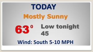
After a cold start in the 20’s, we should make a remarkable recovery into the low 60’s.
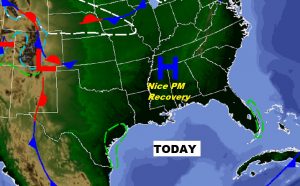
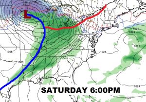
Potent set-up for severe storms over a mulkti-state area from the mid Mississippi valley to much of the Gulf Coast states on Saturday.
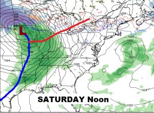
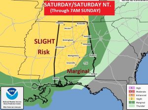
Much of Alabama ins in the stage 2 “Slight risk” area Saturday/Saturday night until 7AM CDT Sunday AM, as far east as Alex City, Montgomery and Greenville. All modes of severe weather including the threat for more tornadoes.
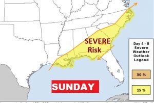
After 7AM Sunday (CDT) the threat shifts to central and south Alabama.
Back to 70’s Friday through Monday. Risk of showers and storms Sat PM/Sunday and more showers Monday.