
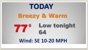
Good morning! We’re in for another breezy, warm, dry day, but weather changes are right around the corner. We’re tracking that storm moving out the Rockies, that will bring rain and thunderstorms to Alabama by Thursday & Friday. The Storm Prediction Center has part of the state in a severe weather risk. Then, get ready. Some much cooler air will be arriving this week. Attention Alabama growers: I’ll show you which 2 mornings in the next week that could end up in the 30’s.
The MEGA-storm moving out of the Rockies moves east today, but for us, just a breezy, warm, dry day.
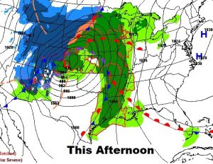
Tomorrow the big storm begins to affect Alabama with showers and storms.
 \
\
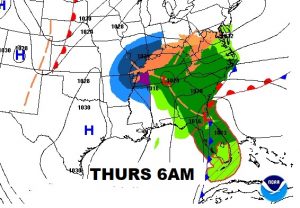
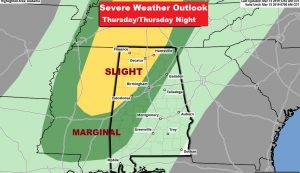
A big chunk of Alabama is in a severe weather risk on Thursday, especially west of Clanton to Selma line. The greatest tornado threat will be in the northwest counties.
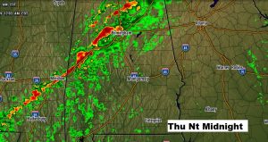
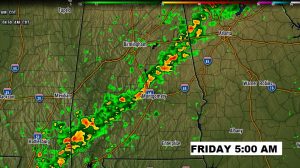
Future radar shows a squall line reaching near the I-20/I-59 corridor by Midnight Thursday night. A weakening line of storm reaches I-85 by about 5AM Friday.
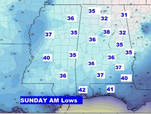
After the storm, colder air rushes in for the weekend on gusty winds. Saturday’s high will struggle to reach 60. We’ll fall to the 30’s Sunday morning.
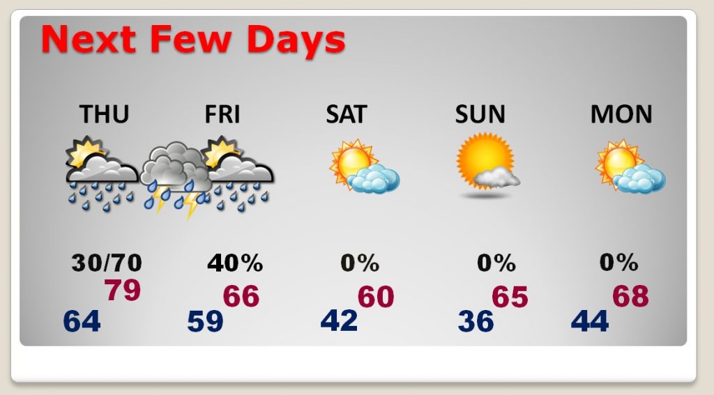
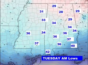
ATTENTION ALABAMA GROWERS: We have our eyes on a couple of mornings in the next week when our lows may fall to the mid 30’s. Looks like Sunday and Tuesday morning will be the coldest.
.