It’s a turbulent start to our brand new week. All of Alabama, and across adjoining states, are in a Severe Weather Risk today. A potent storm systems will produce waves of thunderstorms today and tonight. The front moves through tonight, but there will be a lingering threat of scattered storms tomorrow, as the main storm system lags behind. On this video, I’ll take you through the week ahead. We’ll look at a couple other storm systems on the horizon over the next seven days. Plus, there will be a couple of nice, warm days along the way, too
Severe Weather threat covers all of the state today. Stronger level 2 threat area in NW and NE Alabama, and this area could expand in future outlooks. While damaging wind gusts are the main threat, a few brief tornadoes can’t be ruled out.
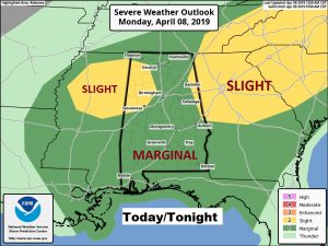
In Fact the local NWS office has an even large Slight Risk Area outlined for today including areas along and north of a Auburn, Wetumpka line.
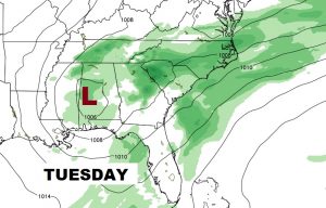
Even though the front moves through tonight, there is a lingering threat for scattered showers and a few storms Tuesday, with the main low. Not severe tomorrow.
After more showers and storms Tuesday…Wednesday and most of Thursday are nice. Another line of storms will move intro the state late Thursday night into Friday. And, there could be a few showers Saturday.
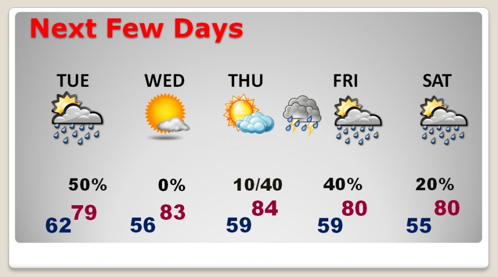
Another line of storms will move intro the state late Thursday night into Friday. At this time, it doesn’t look severe.
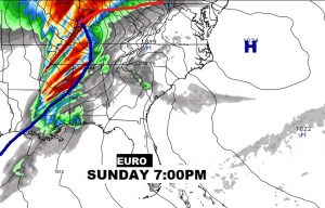
It’s very early,k but the Sunday storm set-up looks concerning, and certainly could be a severe weather situation.