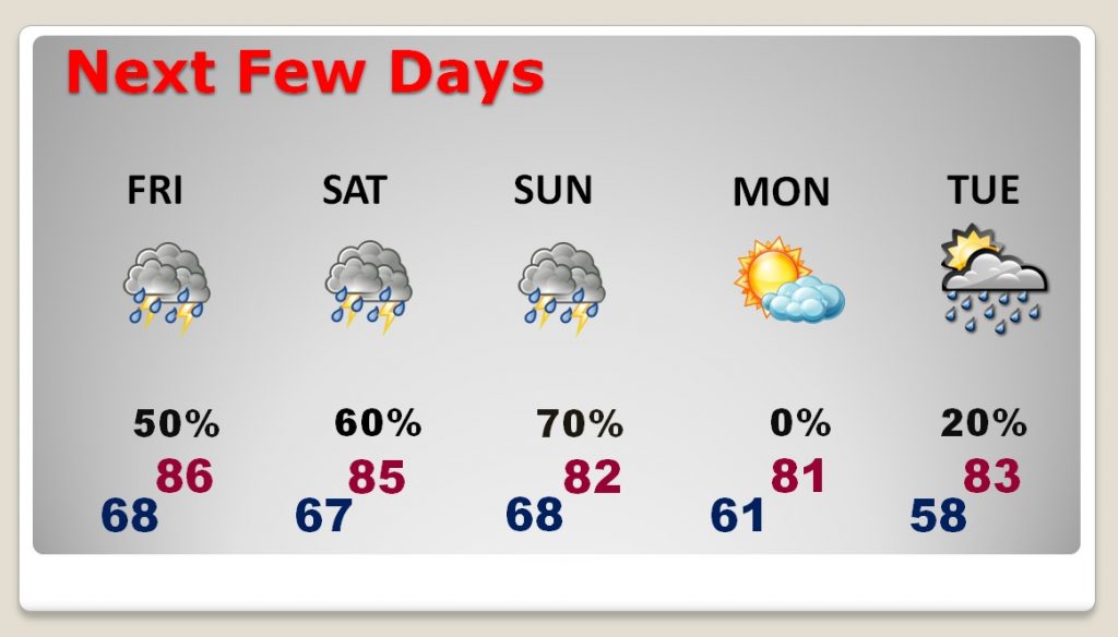
‘Tis the season for thunderstorms and radar watching. The stage is set for an active few days, today through the weekend. Rounds of thunderstorms could affect your plans at times. Some of the storms today could be strong, with gusty winds. The Storm Prediction Center has much of the state in a severe weather risk. I have the latest on the weekend rain chance, and I’ll show what parts of our state could see potentially flooding rainfall.
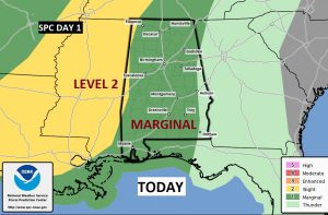
Strong Thunderstorms today. Damaging wind gusts possible. SPC has most of the state in a Marginal Severe Weather Risk.
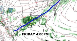
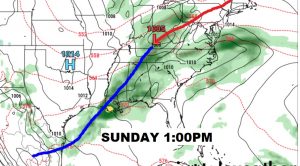
A frontal system will enter the state and stall for a few days. Waves of low pressure will move along the front. Mutiple round of thunderstorms will move through the area next few days.
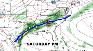
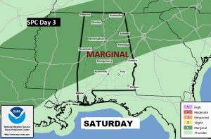
Again on Saturday, SPC has much of the state in a Marginal Severe Weather Risk. Especially in central and north Alabama. Damaging wind gusts are possible.
Wet and stormy at times today through the weekend. Dry weather returns Monday.
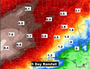
Some parts of west Alabama could see excessive rainfall amounts next 5 days. Lesser amounts the farther southeast you go in the state.