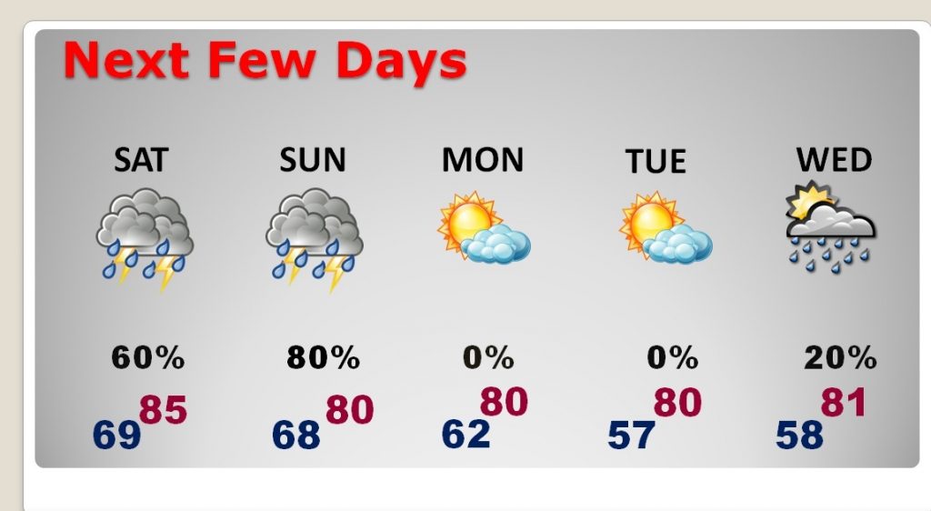
Good Morning! Be flexible with your outdoor plans. It’s going to be a busy Mother’s Day thunderstorm weekend with waves of storms, at times. Have a plan “B” ready. The Storm Prediction Center says some of the storms over the weekend could reach severe limits, like yesterday. I have the latest threat level maps from SPC. Plus, we’ll look at future radar, and I’ll show you which areas could see the heaviest rainfall. And, I’m getting excited about next week.
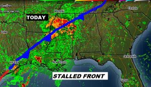
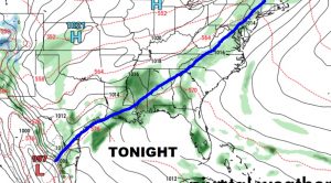
A stalled front northwest of us will be the main player today and through the weekend as waves of storms move across Alabama and the Deep South.
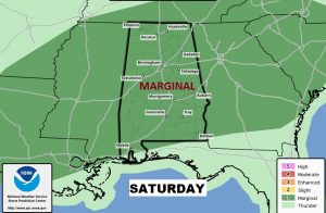
At times, like yesterday, storms will reach severe limits with the threat of damaging wind gusts and hail. The tornado threat is small. Here’s the Saturday outlook, as it stands now.
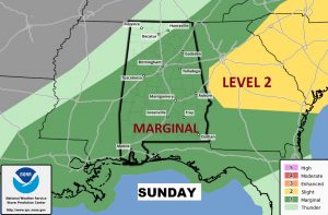
This is the current SPC Sunday Severe Weather Outlook. It’s certainly possible that the yellow severe weather level 2 threat area could be expanded into Alabama on Mother’s Day. Stay weather aware all weekend.
After a stormy and very wet at times weekend, much nicer weather is in the cards for Monday & Tuesday and much of next week as some really nice air takes over.
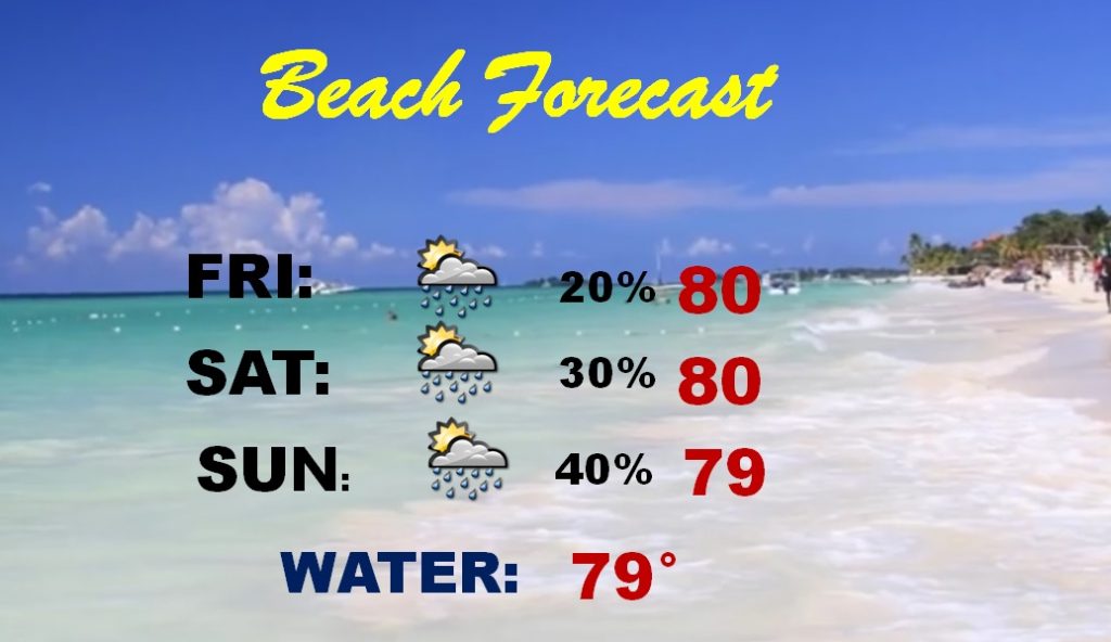
I’ll be honest with you. the Beach Forecast is highly dependent on thunderstorm trends across the Gulf South this weekend. The rainfall probabilities are highly speculative at this point. Have our weather app handy.