
Happy Father’s Day to all the dads out there! Can you feel the humidity? It’s back. At Dawn, with a dewpoint of 70 and a humidity of 94%, it feels like summer again. Along with the humidity, those summertime storms will creep back into the forecast. Although storms will be isolated today, the rain chances will ramp up tomorrow, and storms will be rather numerous Tuesday through Thursday. A few strong storms on Thursday could possibly reach severe limits.
TODAY: More sun than clouds. Hot, humid. High 90 to 92. The chance that an isolated thunderstorm could affect your Father’s Day plans is small. 20% or less for most. There’s a little higher shower risk west of I-65. High today 92. Low tonight 71. Full moon tonight. Light southerly wind today.
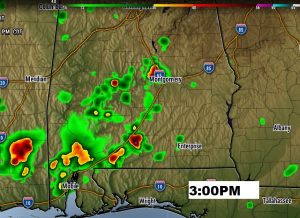
Here’s one future radar snapshot which is a little more bullish of the thunderstorm threat than the other models. Best coverage today over west and southwest Alabama.
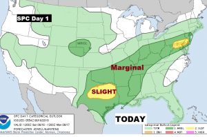
No severe weather in Alabama today, but of you are traveling, much of the eastern and central part of the nation could see some severe storms.
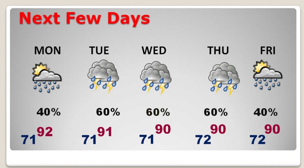
NEXT FEW DAYS: Hot & humid next few days. Summer officially begins Friday at 10:54 AM. Showers and storms will be scattered on Tuesday, but will be quite numerous on Tuesday, Wednesday and Thursday. A few storms could be severe on Thursday.
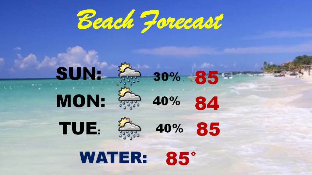
BEACH FORECAST: It’s been a pretty good Father’s Day weekend at the Beach. Isolated storms are possible today, but better rain chances will creep in as the week progresses. Storms will be likely by the middle of the week.
—
I’m back in Montgomery now, after a few days in beautiful San Diego for the American Meteorological Conference.
I’ll have a complete video update Monday morning, online by 4:45AM. Have a nice Sunday. Happy Father’s Day. I’ll see you in the morning.
–Rich