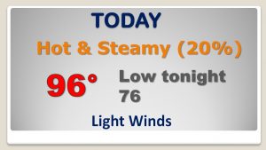
Good Morning! Four words we do not like – Triple Digit Heat Indices. We crossed into triple digit territory yesterday, and it’s only going to get worse through the 4th of July and beyond. We’re headed for a dangerous level. On this video, I’ll show you which days could be the hottest. Plus, I have updated numbers on the rain chances, through the holiday weekend for here and the Gulf Coast.
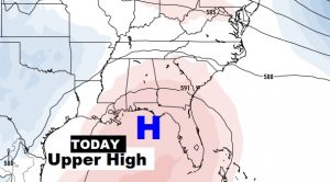
That big upper Level Heat Dome is getting stronger. Intense heat today and next few days with only widely scattered storms.
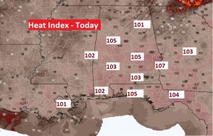
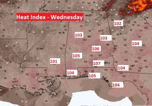
The Heat Index will rise to dangerous levels over the next 2-3 days especially, through the 4th of July and beyond. A heat Index of 105 is the start of the Danger Range.
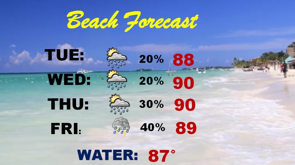
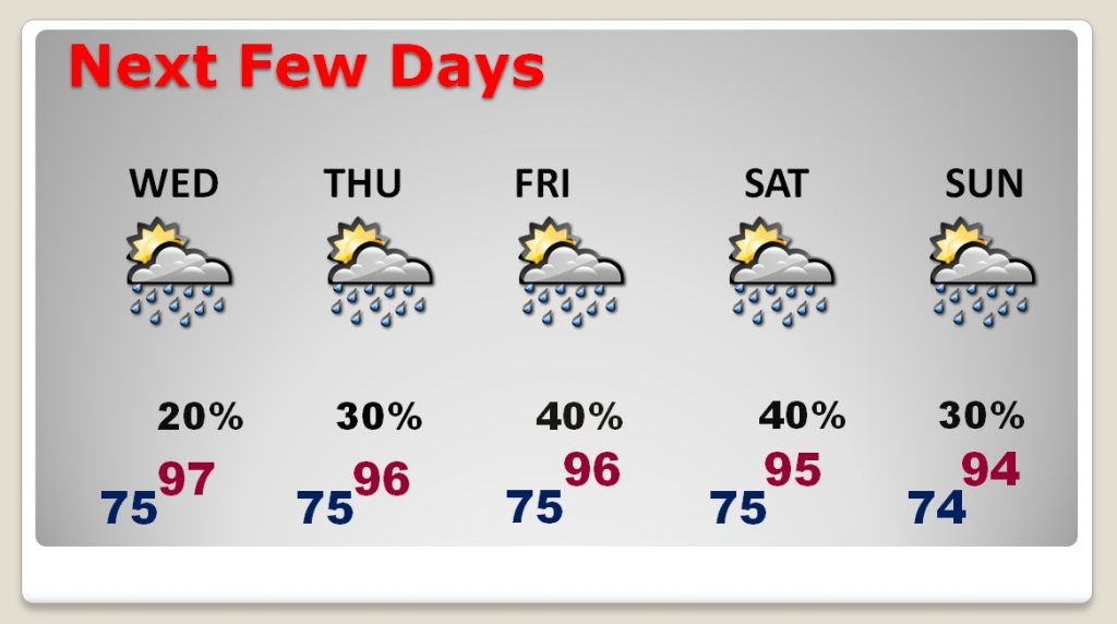
Rain chances are relatively small through Thursday. Chances will get a little better by Friday and over the weekend.
Pay close attention to the Beach flags. Especially over Walton and Bay counties “strong and frequent rip currents area possible.”