
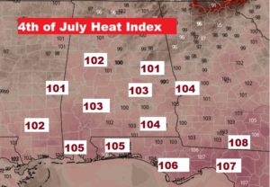
It’s true. Some spotty random storms could affect your Fourth of July holiday plans. But, like most summer days, the storms will be “hit or miss” with more misses than hits. Just be flexible, and be ready to move things indoor for a little while. The big story continues to be the intense heat. Triple digit heat indices again, not only today, but through the holiday weekend. By the way, if you are Beachbound to escape the heat – some of the most intense heat index numbers are closer to the Beach.
TODAY: Text book summer forecast. Sun cloud mix. Hot day. Mid 90’s again. Scattered random storms. Many towns will get skipped. A couple of storms, in this kind of heat, could become quite strong, with intense lightning and gusty wind. Lightning deaths peak on the 4th of July. If you are close enough to hear lightning, you are close enough to be struck. Go indoors.
FUTURE RADAR: Although you should never take Future Radar literally, it does give us a sense of the general storm coverage at various hours. They reach a peak at mid afternoon, and then they become rather spare around Fireworks time at about 9PM.

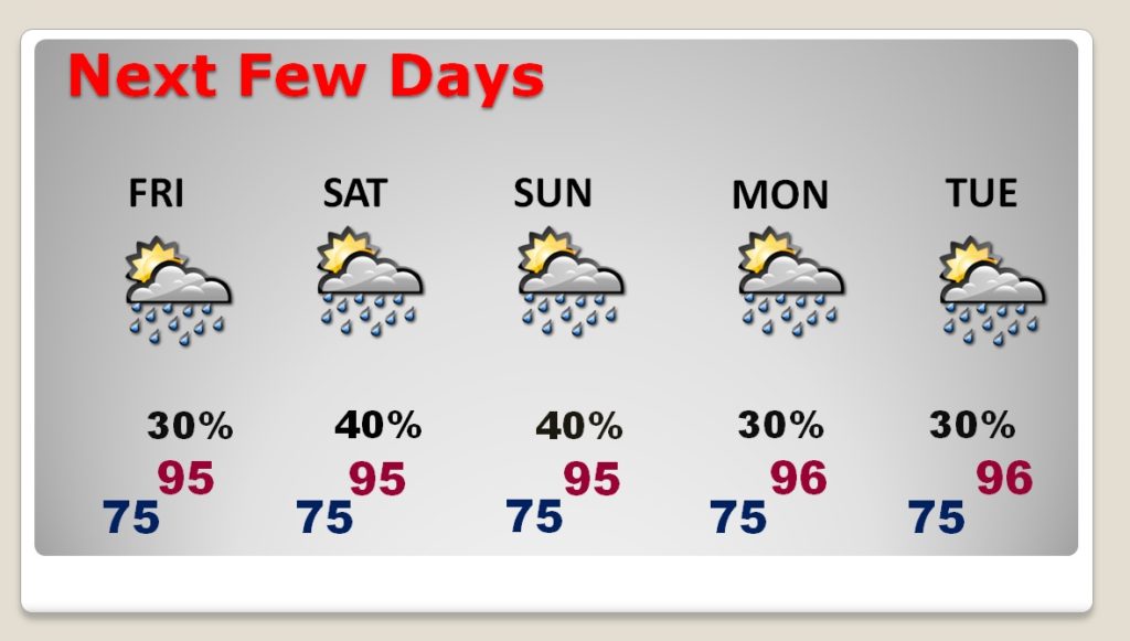
NEXT FEW DAYS: No big surprises. Scattered random storms will be around each day. They will be in slightly better supply on Saturday and Sunday. Daily highs continue in the mi 90’s with triple digit heat indices every day.
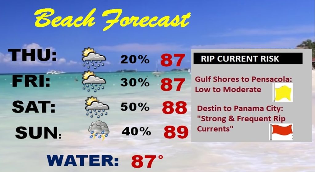
BEACH FORECAST: Heat index close to or exceeding the 105 danger range. Storm coverage south of I-10 will be widely scattered today and Friday. Rain chances get a lot better by Saturday. Watch the flags on the Beach. Officials in Walton and Bay county still warn “strong and frequent rip currents are possible.” That will affect many popular beaches from Destin, through the 30A area, and Panama City, to name a few.
—
I’ll have another Blog Update in the morning! Have a Great 4th of July. Be careful…stay safe and stay hydrated. Happy Birthday America!
–Rich