
It’s getting hotter and more humid. Rain chances, which have been low over the weekend, will get a little better, but not right away. The storms will be few and far between today and tomorrow. It might be time to get out the garden hose. The best rain chances appear to be close to the end of the week. NHC is tracking a new disturbance in the Caribbean. More on that system below.
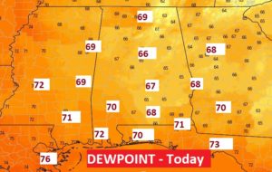
TODAY: Lots of sun Hot and Humid . High in the mid 90’s Although the heat index may stay just below 100, the dewpoints are getting higher today. It’s feeling more humid.
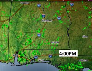
Future radar suggests some spotty storms are possible, but they will be very isolated. Again today, most towns will stay dry.
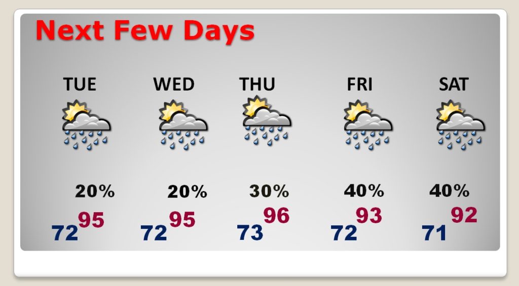
NEXT FEW DAYS: The heat is on as July ends and August begins. Highs in the mid 90’s. The heat index will be near or above 100. Rain chances get a notch better Thursday, and slightly better Friday and Saturday as storms will be in greater supply.
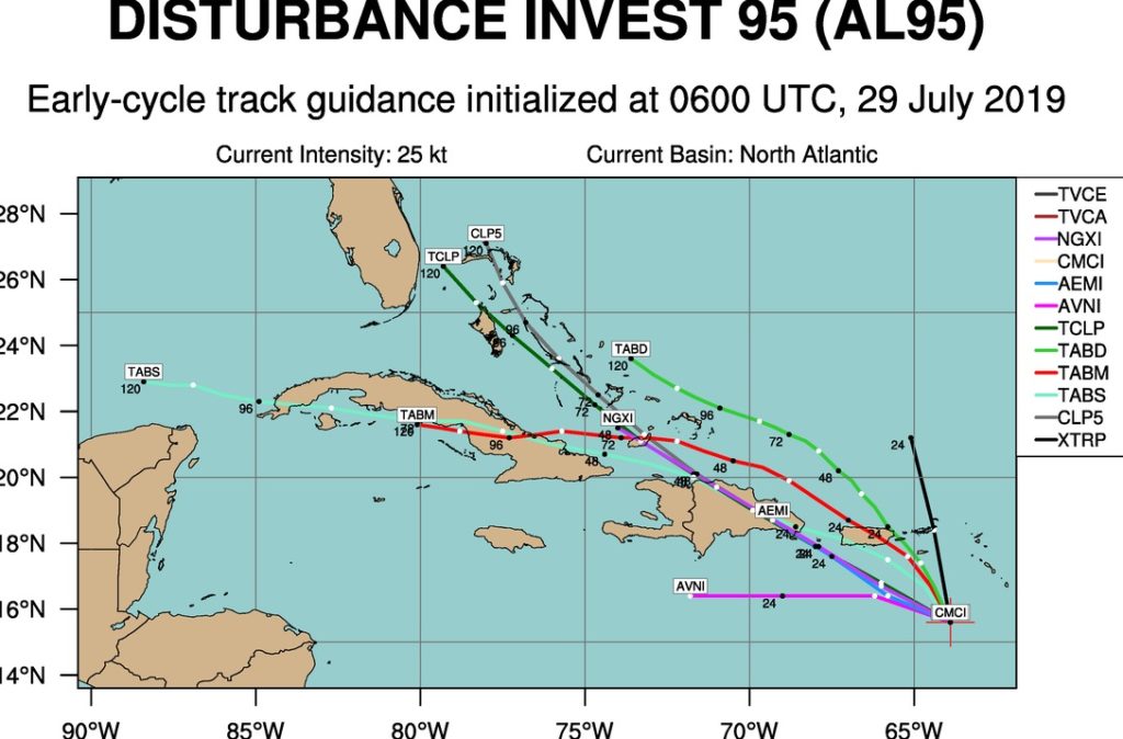
NEW IN THE TROPICS: NHC is now tracking Invest 95-L in the Caribbean. They give this system a small 20% chance of tropical cyclone development in the next 5 days, as the systems moves toward the Bahamas and perhaps the Southeast US later.
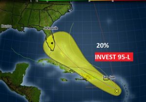
Here’s the early spaghetti models on this system.
—
Good morning! This is a travel day for me… leaving Ohio, after a great Class Reunion weekend.
Tomorrow morning there will be a video, as things get back to normal. Have a great Monday! Stay cool!
–Rich