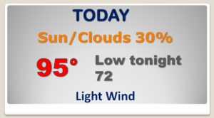
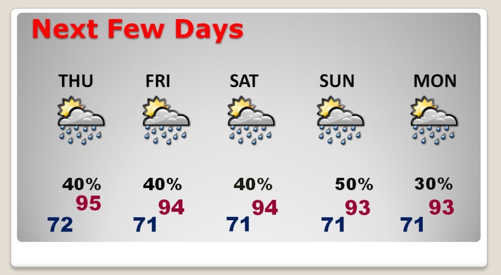
Good Morning! Some of you got rain yesterday and last night. Others may see some showers today. And, over the next few days, finally, there will be more showers to go around. Even this weekend. They will still be random, but your odds of encountering one or a few will be better. We sure need the rain as the drought grows. On this video, I’ll show you Future Radar and update the rain chances through early next week. PLUS – The latest on two systems we’re tracking in the Tropics.
Again today, a little weakness or trough in the upper atmosphere will aid in the development of scattered PM storms. Yesterday thew Montgomery airport had 2.08″ of rain in two showers.
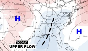
The upper trough becomes more pronounced next few days which will aid in the improvement of our rain chances.
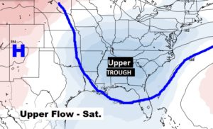
The weekend rain chances are up for debate. It’s possible I may adjust the weekend probabilities higher in future forecasts.
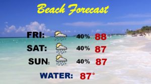
Scattered storms will be roaming around this weekend at the Beach. Certainly not a wash out. Fairly routine.
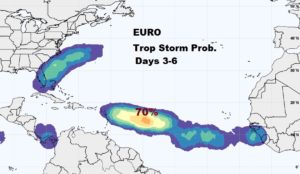
INVEST 95-L, which is a tropical wave approaching the Bahamas has a very small chance of tropical cyclone development next 5 days. But that “area to Watch” off Africa has a much better chance of development in the Tropical Atlantic..

The EURO Ensemble models give the system in the tropical Atlantic very high odds of becoming a Tropical storm in the Day 3 to 6 time frame.