
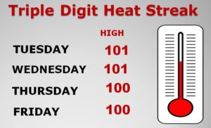
Looks like the five day streak of 100+ degree Temperatures may be over. Yesterday Montgomery tied the Record High from 2000 at 102.
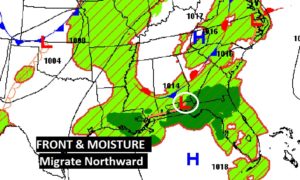
Today, though, moisture from the Gulf will migrate northward along with a frontal system. Humidity returns and so does the chance of spotty thunderstorms. Storms will be in more generous supply in the week ahead.
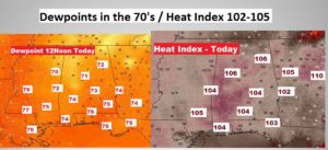
TODAY: You’ll feel the difference. With dewpoints in the 70’s returning, instead of the 50’s like the last two days. That’s a huge difference. Look for a sun & cloud mix. High in the upper 90’s . Let’s say around 97. Spotty thunderstorms will be around. The heat index will range from about 102 to 105. Low tonight mid 70’s.
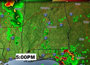
A Future Radar Snapshot, just as an example on possible coverage later today.
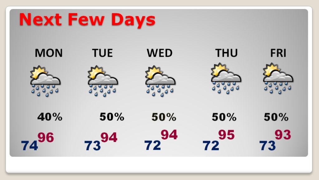
NEXT FEW DAYS: Showers & storms return to the forecast. There will be a generous supply each day, particularly Tuesday through Friday. Highs mostly in the mid 90’s. Triple digit heat indices. We may be close to the criteria for a Heat Advisory some days.
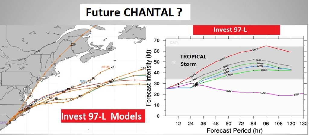
TROPICAL UPDATE: That “Area of Watch” off the Southeast Coast has graduated and has become Invest 97-L. NHC gives it a 30% chance of development, but many models give this system a decent chance of becoming Tropical Storm Chantal in the next 60 hours off the Middle Atlantic Coast. The only other area worth watching right now is closer to our shore along the northern Gulf coast where weak low pressure is developing.

—
I will have a Video for you bright and early tomorrow morning, posted by 4:45 AM. Have a nice Sunday!
–Rich