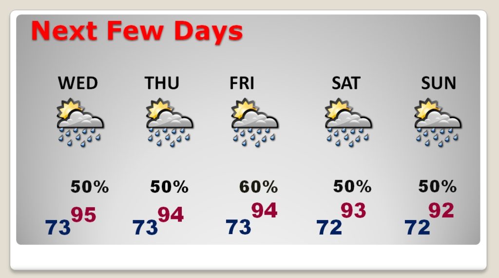
Good morning! The airmass is “soupy” and primed for more action today and over the next few days. Those random storms will be in greater supply for each of the next 5 to 6 days. There will be tropical downpours in spots and a few strong storms. Outside of storm areas, expect more triple digit heat, perhaps near or close to the 105 danger range. On today’s video, we’ll look at the day by day details for the rest of the week and through the weekend. Are the tropics about to wake up?
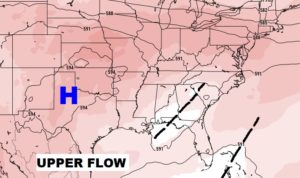
The atmosphere is primed today, like yesterday. Upper trough in place. Plenty of heat and ample moisture. Storms will be scattered to numerous again. Some storms will be strong with potential gusty winds and downburst winds. A few warnings are possible again today.

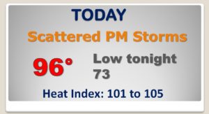
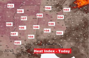
Outside of thunderstorm areas, the heat will be intense with a heat index near the 105 danger range in spots.
The better than normal rain chances will continue for the next several days through the weekend, The storms will still be random, but rather numerous.