(10:00AM Wed 8/28 UPDATE)
GULP……
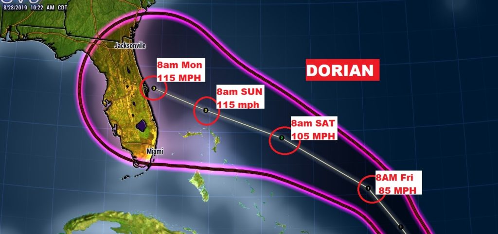
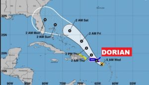
Concern is growing with Dorian’s new forecast cone.. NHC is now projecting Major Category 3 Hurricane Dorian approaching the Florida coast in the Sunday/Monday time frame, with potentially 115 mph wind.
Many questions remain about the track and intensity, but the level of concern is growing. Where does it go after Florida? Good question…… ALL EYES ON DORIAN.
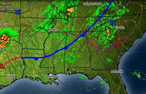
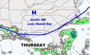
Good morning! A frontal system moving through our state today will deliver some nicer air.. Best chance of showers will be in the southern half of the state today. Cooler nights are on the menu for tonight and Thursday night and lower humidity for a couple of days. But, hold the phone. The Southeastern US may have an unwanted encounter with that storm named Dorian over the Labor Day Weekend. What track will it take? The models do not agree. Will it affect US after Florida? I have the very latest model data and the updated forecast cone from the Hurricane Center on your very interesting Wednesday morning weather briefing.
Frontal relief soon. Maybe some morning showers then drier air follows for this afternoon and tonight.
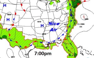
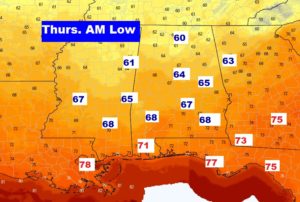
How about a couple of nights in the 60’s and lower humidity days on Thursday and Friday?
The New NHC DORIAN Cone shows that Dorian could be a 100 mph Hurricane very near the Florida Coast by late Sunday night. the cone has now swallowed all of Florida. Then what? Does it make a left hand turn or go to the right?
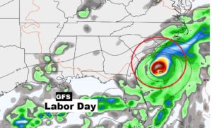
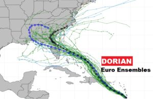
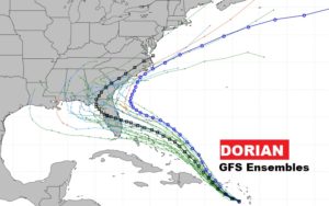
Models show VERY different potential tracks on Dorian’s Future position and intensity. Here’s the Euro and GFS solution at 1PM on Labor Day. Hundreds of miles apart.
These are the EURO and GFS Ensemble spaghetti model tracks.
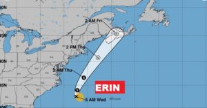
Tropical Storm Erin…we could care less about.