
A Hurricane Warning has been issued from Jupiter Inlet to the Volusia/Brevard County Line. A Hurricane Watch has been issued from the Volusia/Brevard County Line to the Flagler/Volusia County Line.
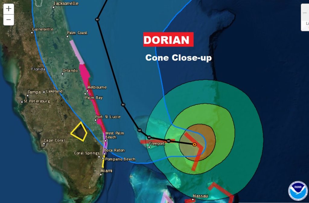
At 4PM CDT:

Dorian located ABOUT 95 MI...150 KM E OF FREEPORT GRAND BAHAMA ISLAND
MAXIMUM SUSTAINED WINDS...185 MPH...
PRESENT MOVEMENT...W OR 270 DEGREES AT 5 MPH..
MINIMUM CENTRAL PRESSURE...910 MB...26.88 INCHES

NHC TECHNICAL DISCUSSION:
Given the uncertainty in the track forecast and the anticipated increase in size of the hurricane, a Hurricane Warning and Storm Surge Warning have been issued for a portion of the Florida east coast. It is once again emphasized that although the official track forecast does not show landfall, users should not focus on the exact track. A small deviation to the left of the track could bring the intense core of the hurricane its dangerous winds closer to or onto the Florida coast. Key Messages: 1. A prolonged period of catastrophic winds and storm surge will affect the Abaco Islands and Grand Bahama Island tonight. Everyone there should take immediate shelter and not venture into the eye. 2. Life-threatening storm surge and dangerous hurricane-force winds are expected along portions of the Florida east coast through mid-week, and storm surge and hurricane warnings are in effect. Only a slight deviation to the left of the official forecast would bring the core of Dorian near or over the Florida east coast. Residents should listen to advice given by local emergency officials.CONE CLOSE UP DETAILS:
· · ·