11AM EDT DORIAN UPDATE:
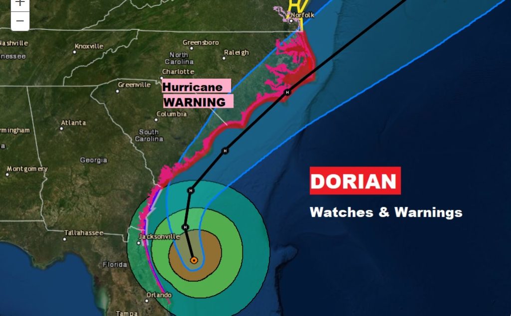
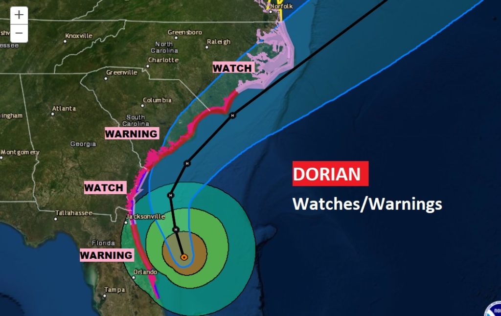
Hurricane Warning extended northward to the Virginia border. Dorian is still a Cat 2 Hurricane with 105 mph winds, pressure 964 mbs. Located 90 miles ENE of Daytona Beach, moving NNW at 9 mph. Hurricane warning now extends all the way up the coast from Florida through the Georgia coast, and through the Carolina coasts.
Here’s a close up of the Updated Hurricane Warning all the way north to the Virginia border. And, the updated track on the 11am Advisory
EARLY MORNING UPDATE:
Dorian is battering the east coast of Florida this morning on a trek that will take it dangerously close to the Carolinas on Thursday & Friday. There are no less than 5 systems we are tracking in the tropics. I have the latest from the National Hurricane Center. Meanwhile, for us…get out the garden hose. The rain prospects are NOT good for several days. Could be headed for to 100° days by the weekend? How long will this last?
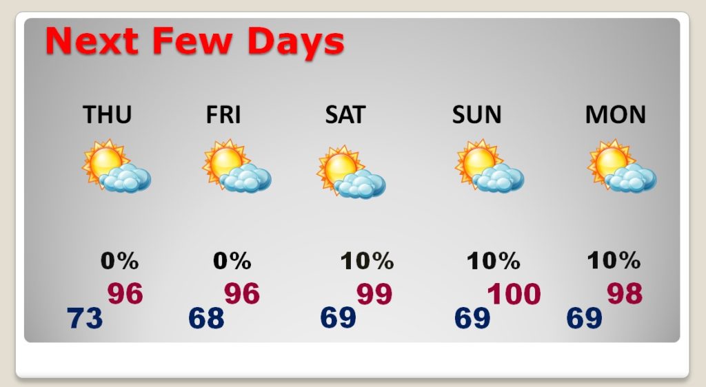
TWO tropical systems on the map…but, we are in between. HOT and DRY again today.
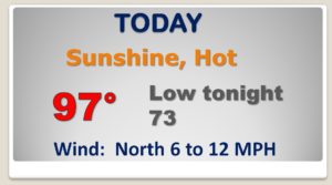
Rain prospects are NOT good for several days. Just hot and dry. Very near 100 Saturday through Monday.
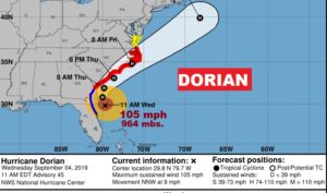
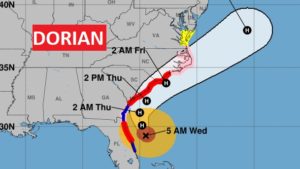
DORIAN is still category 2 with 105 mph winds, 90 miles east of Daytona Beach and 5AM EDT, moving NNW at 8
VARIOUS levels of Hurricane Warnings and watches from the Florida east coast north to Norfolk.
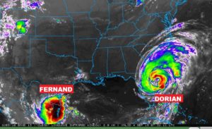
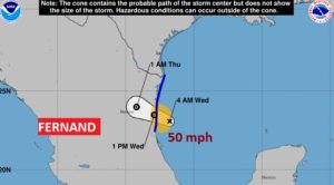
Tropical Storm Fernand in the southwest Gulf will move inland over Mexico today with heavy rain.
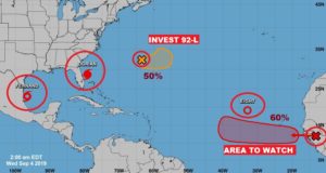
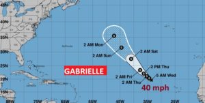
Tropical Storm is BRAND NEW in the tropical Atlantic with 40 mph winds.
There are now a total of FIVE systems in the Atlantic Basin being tracked by NHC. It’s busy!