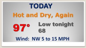
Good Morning! Hurricane Dorian is stronger and has regained Category 3 status as it nears the Carolina coast. I have the latest on Dorian’s close encounter with the United States. Elsewhere in the tropics, it is very busy with 5 systems being tracked. Which ones could affect land? For us after 99° yesterday, we have some very HOT and DRY days on the menu. How long? When will showers return to the forecast. I’ll cover it all on your Thursday morning personal weather briefing.
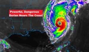
Just Hot and DRY for us for now. Spectacular Satellite presentation on Extremely Dangerous Dorian off the SC coast.
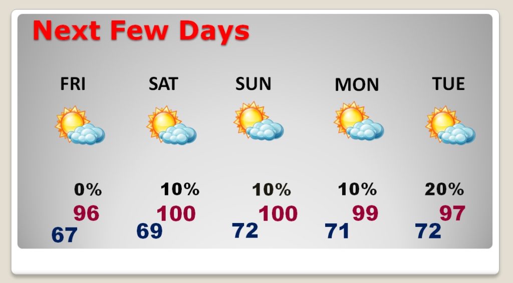
Very HOT and DRY through the weekend. Highs near 100 Saturday through Monday. Widely scattered storms Tuesday.
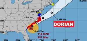
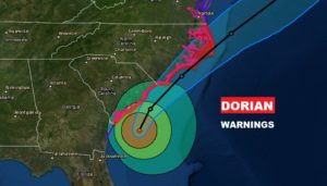
Dorain is stronger. Category 5 again, with 115 mph winds, 80 miles SSE of Charleston, moving north at 10. It will make a dangerously close encounter with the SC coast today and could make the first landfall in the United States by tomorrow in NC.
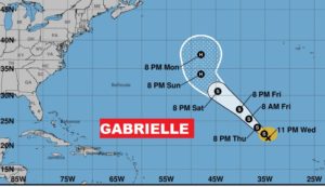
Elsewhere, Tropical Storm Gabrielle in the tropical Atlantic could become a hurricane this weekend but won’t bother anyone.
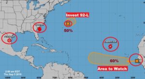
Their are FIVE systems in the tropics being tracked. A hurricane, Tropical storm, tropical depression Fernand, and Invest o2-L, and an Area to Watch off Africa. BUSY!!