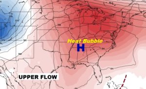
Good Morning! The intense late summer heat continues today. In fact, even the chances of seeing a shower will be very remote through the end the week. BUT, we’re watching the tropics. Invest 95-L in the Bahamas could be the system that brings our next best chance of rain, perhaps by Sunday & Monday. Keep the fingers crossed. I have the latest model runs. And, there’s a couple of other systems we’re watching, too.
Another very hot summer day today. Highs in the upper 90’s Heat index 100 to 105. Isolated storms can’t be ruled out, but the chances are 20% or less.

Several systems being monitored in the tropics. Invest 94-L near the Leeward Islands could be a player down the line in a few days next week as it heads in the direction of the Bahamas and the SE US. But, closer to home, Invest 95-L could have an impact on Alabama’s weather before this weekend is over.
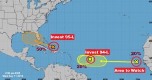
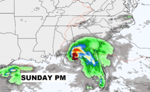
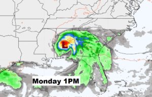
NHC gives 95-L a 50% chance of development into a Depression over the weekend in the Gulf. Some of the model tracks take the system into Alabama.
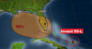
The EURO model likes the Idea of this Tropical Low moving into Alabama maybe late Sunday, through Monday & Tuesday, which would bring very beneficial raindrops to the state,
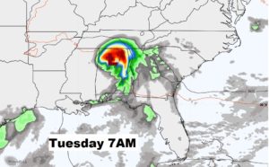
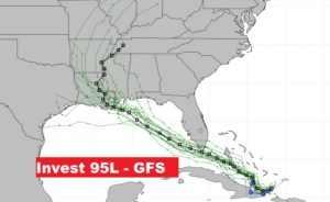
The American GFS model tracks the system farther west. Most of the ensemble members are west of Alabama. Stay tuned.