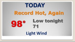
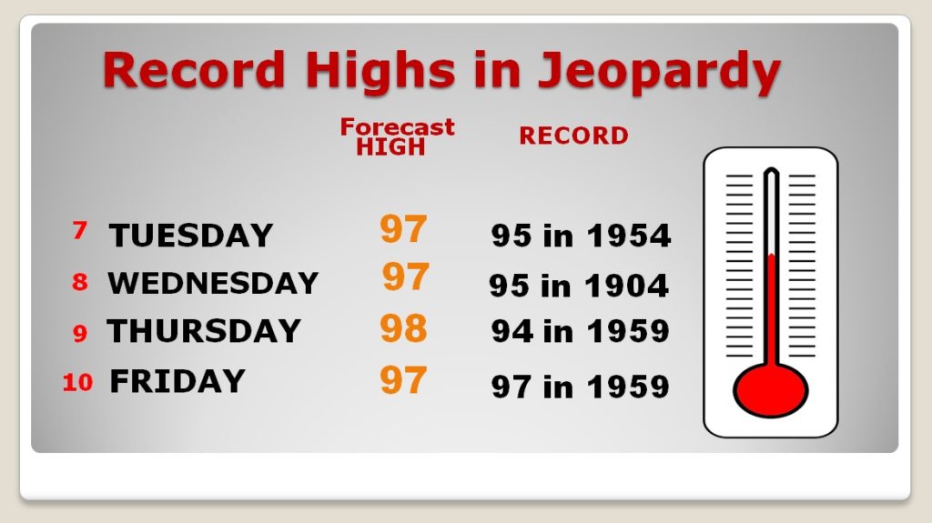
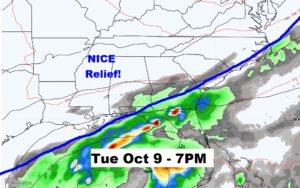
Hang on! We’re still a few days away from some nice relief, but it’s coming. A major pattern change is on our future, as a cold front moves through the state early next week. It will bring a band of showers and thunderstorms ahead of it, and much cooler, comfortable air behind in it’s wake. In the meantime, it’s business as usual. The drought grows worse. The Record High streak continues. Today is Day 7 of Record Highs. The streak continues through Friday. Could there be some isolated showers this weekend? I have updated your forecast on your Tuesday morning video briefing.
Today’s record high of 95 should be easily broken. Record Highs will fall in dozens of cities from Galveston Bay to Lake Erie.
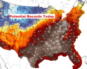
HOT and DRY next few days. Record highs in jeopardy through Friday. Not as hot over the weekend with isolated showers.
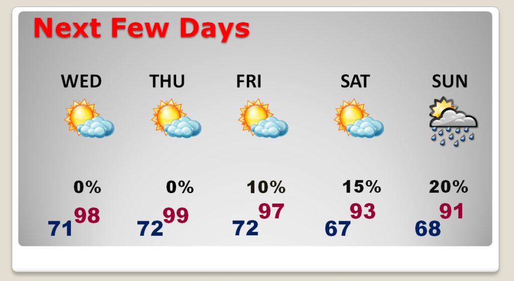
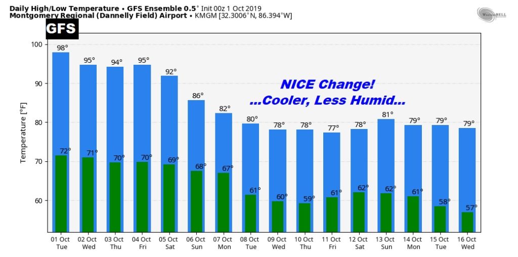
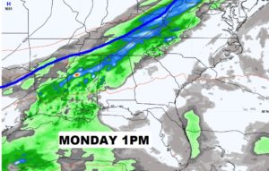
Hang on! We are just a few days away from some Cold Front relief. A band of showers and thunderstorms, ahead of the front, will enter the state Monday and head southward. Some much nicer air will overspread the state during the day Tuesday. Cooler and less humid.
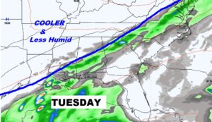
After the front, what change! Much cooler days, and and clear, cool comfortable nights.