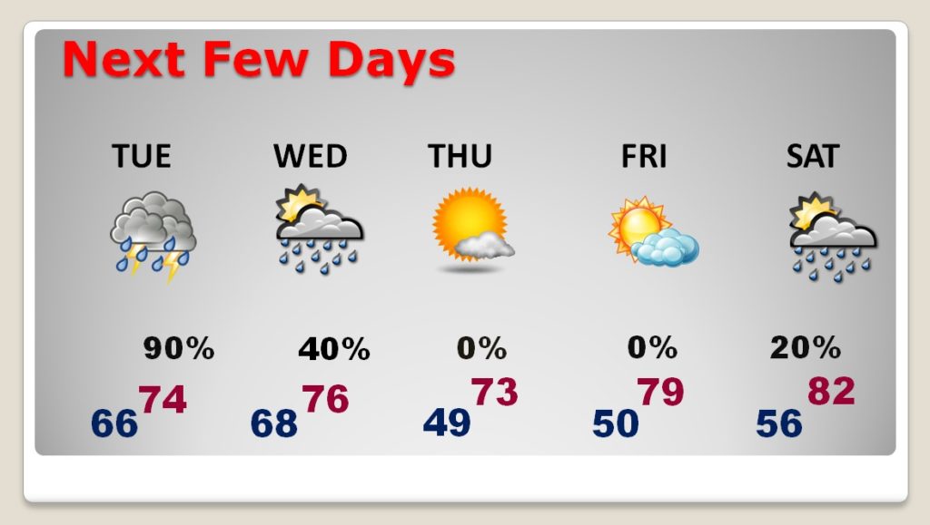
Good morning! Get ready for big changes ahead. Looks like the potential for a significant rainfall event beginning overnight tonight through Tuesday until a strong cold front shuts off the rain by mid-day Wednesday. Where will the heaviest band of rain be? I have an update on who could see the heaviest rain. Then, how chilly does it get behind the Cold Front? Will jackets need to come out of the closet. And, a tropical Low in the Gulf could affect next weekend’s weather. I’ll bring you up to speed on your Monday morning personal weather briefing.
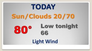
That front near the coast will be a player later today and tonight, as it begins to migrate northward. Heavy rain begins in the wee hours of the morning. Today will the warmest day of this week. Happy Columbus Day.
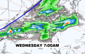
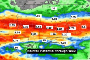
Locally heavy rain, at times, especially from late Monday night through mid day Wednesday, when a strong cold front shuts off the rain.
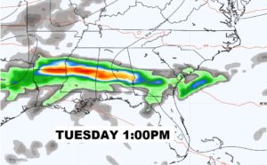
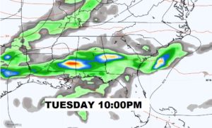
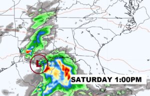
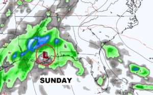
This map speaks for itself. Looks a significant rainfall eve for many of us. See where the heaviest rain band has now shifted? Looks nice, huh?
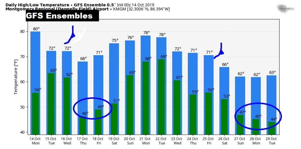
After the Strong Cold Front brings an end to the heavy rain by Mid Day Wednesday, get ready for sharply cooler weather for 2-3 days. Jackets ready? Rain returns next weekend.
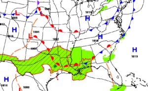
Strong Cold Front #1 Wednesday, with the chillest mornings on Thursday & Friday. Another strong cold front around October 25th, and a series of chilly mornings after that.
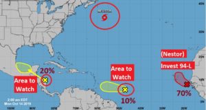
That Area to Watch in the Caribbean, will move into the Gulf. From that, a Tropical Low could have an impact on our weekend weather here. Maybe. Just saying….