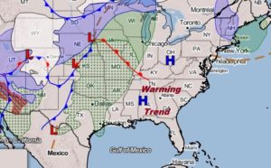
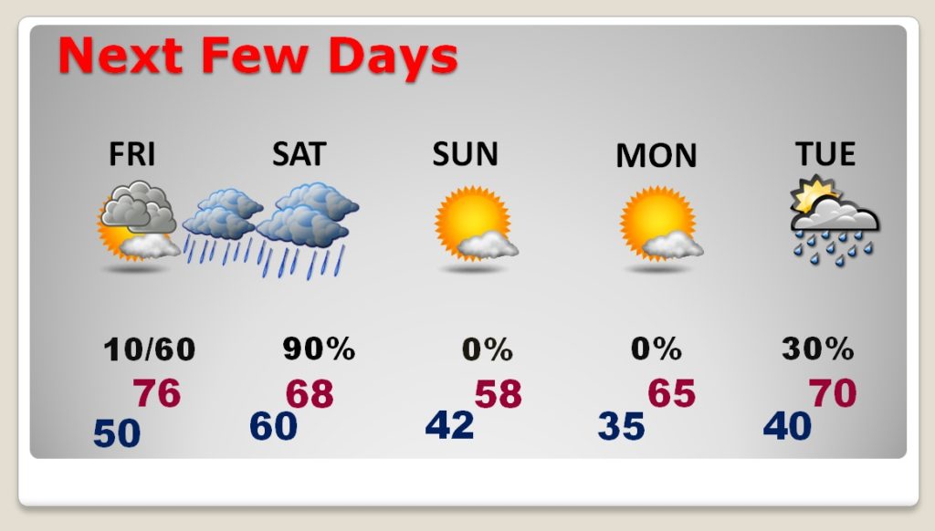
Good Morning! Our string of nice days is just about over. Still beautiful today. The warming trend continues through Friday. But, and approaching cold front will bring showers to the state, followed by a big cool down by later in the weekend. Timing has changed a bit. On this video, I’ll break down the details and we’ll look ahead to Thanksgiving Week. How could a storm system affect your holiday travel plans? Could Arctic Air invade Alabama during the first week of December?
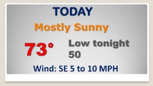
Looks kike our current string of perfect days is ending. PERFECT today. Highs into the low to mid 70’s. Changes soon…
FRONT BRINGS A BIG CHANGE: Showers and thunderstorms become likely Friday night and Saturday. The showers end by Satrurday evening. Much cooler air Saturday night into Sunday.
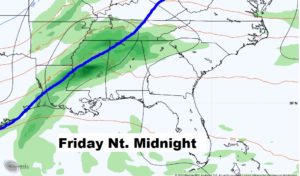
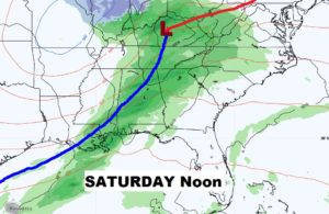
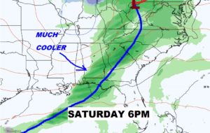
Good chance of rain and maybe some thunderstorms Friday night in through much of Saturday, ending by Saturday evening as much cooler air filters into the area.
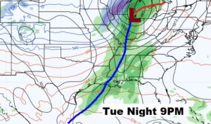
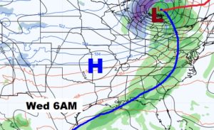
Could there be a significant storm system next? Potentially affecting holiday Travel from the Great Lakes to the Gulf Coast? The models disagree on the details. Best guess right now…Showers and Thunderstorms Tuesday night into early Wednesday. We’ll continue to monitor.
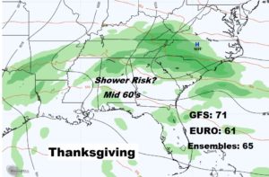
The models DO NOT agree on the details of the Thanksgiving Day forecast. SO, this is what’s called a Low Confidence forecast. For now I’ll just say. Risk of showers. I’ll take the mid ground on high temperatures. Perhaps low to mid 60’s. Keep checking with me every day as this forecast come into better clarity.
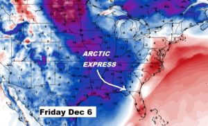
I mentioned this yesterday. The GFS still likes the idea of another one of those Arctic Cold front arriving sometime during the first week of December. ??? We’ll continue to monitor.