
EARLY MORNING BLOG UPDATE:
Good morning! Welcome to the last day of November. The Game Day weather couldn’t be better!. More on that below. But, get ready for a big change of reality. A storm system will move in tonight, with showers and thunderstorms. I’ll bring you up to date on the Severe Weather Threat. Then, as December begins, our temperatures will begin to take a big plunge. Another change of wardrobe, for maybe 3 days, before we start to moderate.
We’ve been spoiled the last few days with highs in the 70’s. By Monday, we may not reach 50 degrees.
TODAY: This string of great days continues for at least today. The month of November will end on a very warm note. There will be some sunshine. Clouds will increase during the day. South wind 6 to 12. High 77. Showers and thunderstorms arrive tonight, and for most of us, especially late tonight. Becoming windy tonight. Low 62.
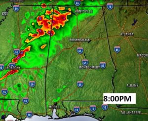
Here’s Future radar at 8PM. We will be dry this evening. Storms come later.
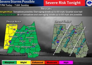
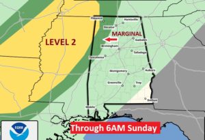
SEVERE WEATHER RISK?: I’ll be honest with you. The Severe Weather Threat overnight tonight is small, but not zero. Last Wednesday morning, we had tornado damage in Pike and Barbour county from a similar storm system. (Two weak tornadoes touched down) Tonight, we have a Marginal Severe Weather risk across the area, in the overnight hours, reaching southeast Alabama just before Dawn. Make sure you have your weather radio in the alert mode. OUR weather app will instantly alert you to a warning for your area…even with an audio cue, if you have that feature turned on.
DIFFERENCE OF OPINION: The Local NWS office in Birmingham has all of us in the risk area. The Storm Prediction Center does not.
The main threat would be damaging wind gusts to 60 mph. But, in these November/December weather situations, there’s a great deal of directional shear. Brief tornadoes can not be ruled out. A small risk, yes But, like last Wednesday, it can happen.
This graphic from NWS Birmingham shows most of us in the risk area, except for the far eastern and northeast counties. It also shows some guidance on the timeline.
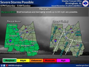
Meanwhile, the Storm Prediction Center keeps the risk across extreme NW Alabama. Just wanted to make you aware of that. I agree with the local NWS officials. It’s better to err on the side of caution.
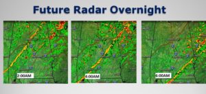
Here’s some Future Radar snapshots during the overnight hours.
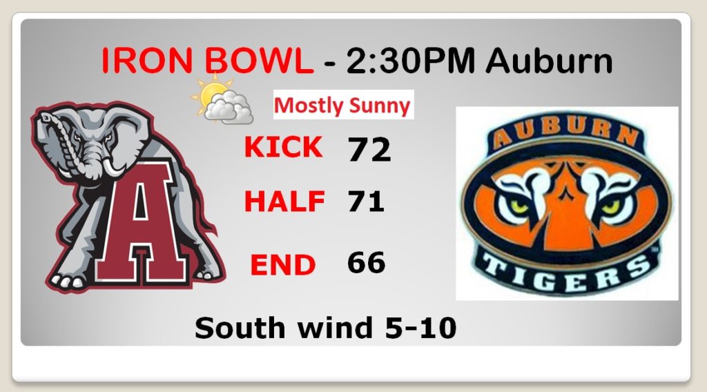
GAME DAY FORECAST: What can I say? It’s one of the BEST Iron Bowl weather forecasts in years. PERFECT. Cool start at Dawn near 50. Nice warming. Low 70’s at Kick, mid 60’s at the end. Lots of sun. Light south wind. Epic forecast. Enjoy the game!
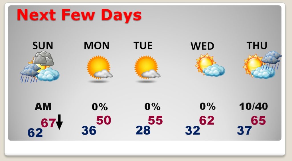
NEXT FEW DAYS: Risk of showers ends early Sunday morning. Then, windy and turning colder. High temperature in the morning…then falling. 30’s Sunday night. Monday’s high may not reach 50 degrees. 20’s Monday night. COLD start to December. More rain from the next storm system Thursday night and Friday.
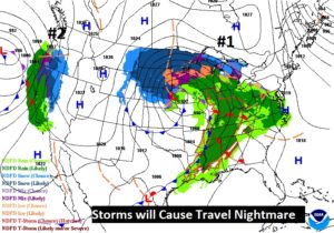
TERRIBLE travel scenario for travelers, coast to coast. Expect significant airline delays today and tomorrow
—
Bailey and I will be heading northward from the coast this morning. I’ll be watching the game on our couch. And, I’ll be awake overnight, watching radar and monitoring the storm threat. Another Blog in the morning. The next video will be Monday morning. It’ll be tough to leave the coast!
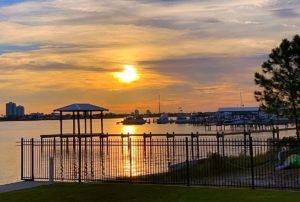
Final sunset last night from down here…
Rich