
We have a dismal forecast on this first full day of winter. Expect soaking rain, and gusty winds all day today & tonight, and leftover showers first half of the day Monday. But, hang on! As you will see on this blog update, we have a simply beautiful Christmas Week Forecast.
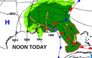
Here’s the culprit. A Low Pressure ‘Gale center’ over the northern Gulf is moving northeastward. Rain and wind for us. Severe weather threat in Florida today.
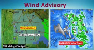
TODAY & TONIGHT: Windy with Rain. Rainfall could be heavy at times. NE wind 15 to 25 gusting to 35+ mph at times. High 53. Low tonight 48.
WIND ADVISORY in effect. Here’s a peak at the EURO Model showing potential Wind Gusts to 40 mph in spots.
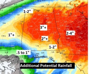
ADDITIONAL POTENTIAL RAINFALL: Some of us could see two additional inches of rain today, tonight and Monday.
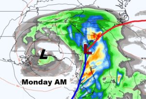
MONDAY: The surface Low moves toward the SE coast, but the Upper Low lags behind. Good chance of occasional rain first half of the day. Slow improvement Monday afternoon. High upper 50’s to near 60.
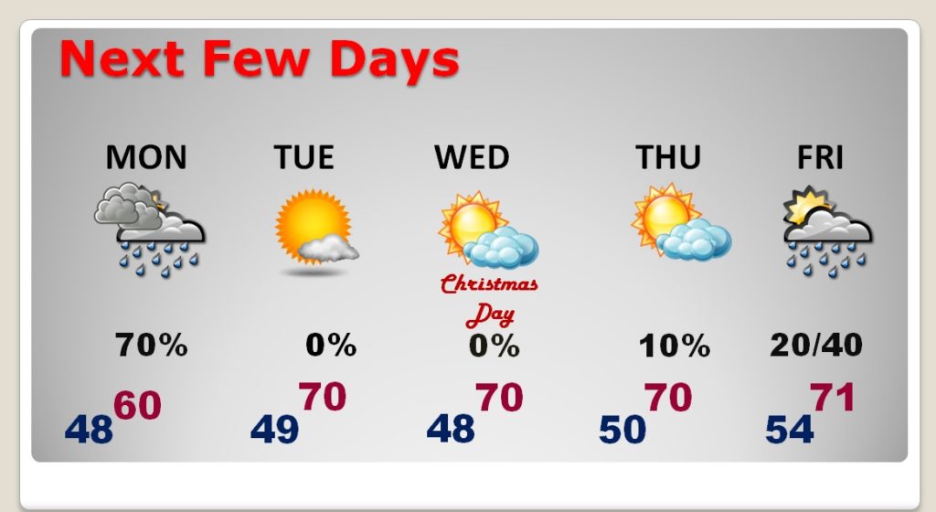
NEXT FEW DAYS: After the rain ends Monday, look for an absolutely beautiful Christmas Week. Highs near 70 Tuesday through the end of the week. Chance of showers by late Friday and Friday night. Better chance Saturday.
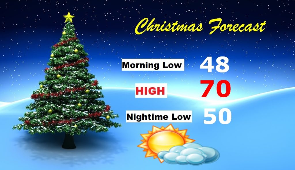
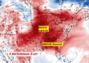
CHRISTMAS FORECAST: This forecast speaks for itself. Just BEAUTIFUL. Much of the eastern 2/3 of America will experience well above normal temperatures. No White Christmas. Best chance for a White Christmas is the Rockies.
I will have a video update for you first thing tomorrow morning at 4:45AM. Stay dry. I have a nice fire in the fireplace and Christmas movies playing. Have a nice Sunday! I’ll see you in the Morning.
–Rich