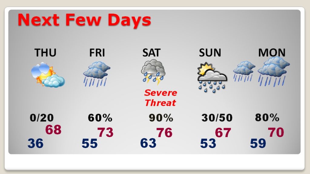
Good Morning! Our weather is quiet, and pretty nice today and tomorrow. After a cold start this morning, but we’re headed for the 60’s this afternoon, and tomorrow will be warmer. However, confidence continues to grow for what could be significant outbreak of severe weather Saturday. The threat includes damaging wind gusts, 70+mph, and tornadoes. On this video, I have the latest from the Storm Prediction Center. Plus, an update on the timing. The action could begin early Saturday, with the threat continuing for much of the day. Be aware, and be prepared to be very flexible with your plans. This is not a standard severe weather threat day. If you live in a manufactured home, think about where you could move to a safer structure to ride out a tornado watch. Now is the time for planning.
Nice quiet day today with a nice afternoon warm-up after a chilly start.

Nice and quiet Thursday. Warmer. Into the 70’s Friday with scattered showers. Significant severe weather event Sunday. THEN, the front returns northward, and stalls over Alabama Sunday night into Monday and Tuesday.
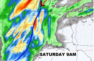
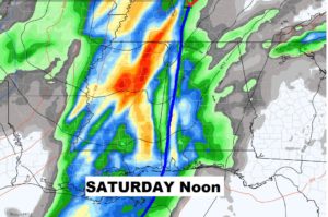
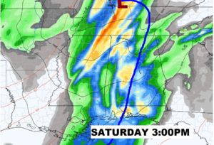
Severe Weather action could begin along Alabama’s western counties by 9am and work eastward with the front during the day, and out of the state by about 6PM.
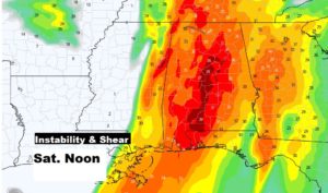
There are many factors that make up a Severe Weather Threat. Two important ingredients are Shear or spin AND Instability or lift. BOTH will be in ample supply Saturday. This is something called the K factor, which combines those two ingredients. Levels will be high Saturday. Here’s a NOON snapshot from the EURO model.
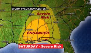
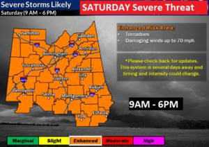
SPC maintains a higher ENHANCED risk area for much of the state Saturday. Significant risk of damaging wind gusts 70+ mph and tornadoes. Perhaps a few strong tornadoes.
LOCAL NWS Threat map from the BHM office extends the ENHANCED risk to the Georgia line and I think this is a prudent outlook. It continues the timing from 9AM in the far west to 6PM in the far east. This could change in later forecaasts.
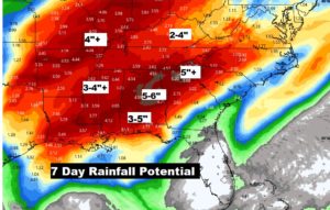
Rainfall amounts over the next seven days could become quite excessive to say the least. Rivers levels which are already high, will need to be closely monitored for the Flooding Threat.