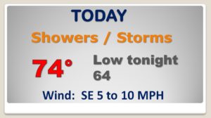
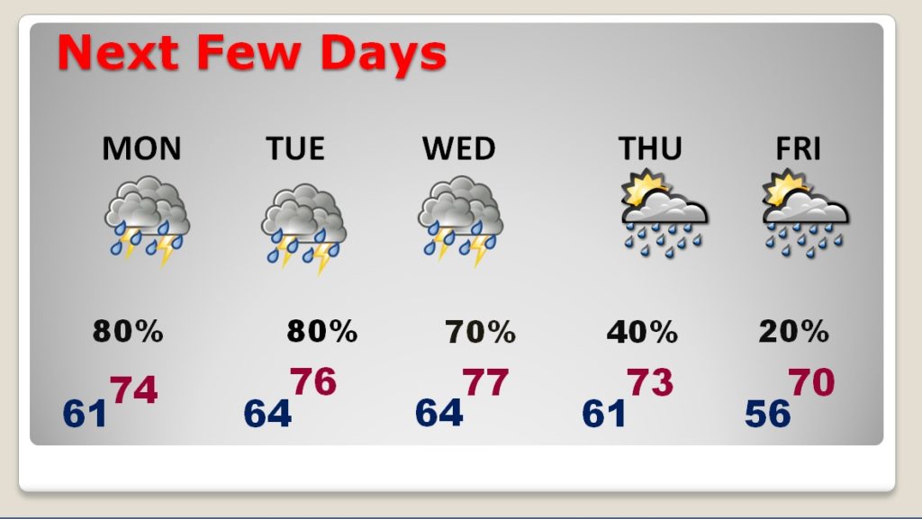
Good morning! Some heard may have been awakened by thunder & lightning overnight. Get used to that. A stalled front will keep the threat of rain will be in the forecast for the next few days, along with Spring-like warmth. It will feel more like April. How much rain and when do we get a break? I see some colder air in a few days. I’ll show you when the when warmth will finally break.
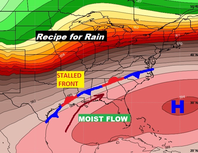
The stalled front will be the focus for waves of showers and thunderstorms today and tonight.
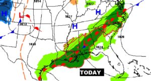
This map speaks volumes about our week ahead, Stalled front. Moist southwesterly flow pumping in copious amounts of moisture. War and wet times this week.
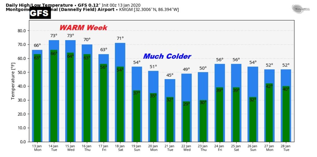
This looks more like a week in APRIL not January. Wet and unusually warm.
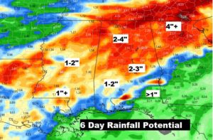
Lots of additional rain over the region in the week ahead.
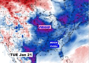
Much Colder air arrives Sunday. 50s instead of 70’s. Then gradually colder Monday & Tuesday. Hang on Cold Weather Fans. It may only last for a few days, but it looks like we’re less than a week away from a big change.