
Get ready for a change of climate. We were in the mid 70’s on a couple days this week. Monday’s high will only be in the mid 40’s. Tuesday AM, we will be in the low 20’s with Wind Chill in the Teens. (Normal high 57, low 36)
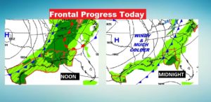
The Cold Front will enter Alabama around lunch time, and exit the state around Midnight. Expect rain out of ahead of the front, and sharply colder air behind the front. Sunday will be a blustery day. MLK Day, Monday will be a rather raw January day. Much of the week ahead will be well below average.
The Next Cold Frontal approach will bring in a round of showers and storms by Friday.
Here’s the maps showing where the front will be at Noon and Midnight.
TODAY: This will be the last Spring-like day for awhile. High 67 to 70°. Best showers and maybe a couple of thunderstorms starts after lunchtime and continues into tonight. When the front passes your location the showers threat will end. It will become windy and colder overnight. Low by Sunday dawn will be 41.
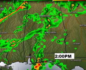
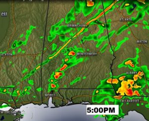
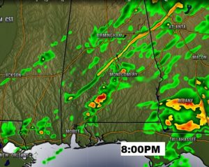
FUTURE RADAR: Unlike last Saturday, no severe weather is expected. Here’s a sample of some Future Radar Snapshots at 2PM, 5PM, and 8PM, just to give you an idea on the coverage and progress of the rain.
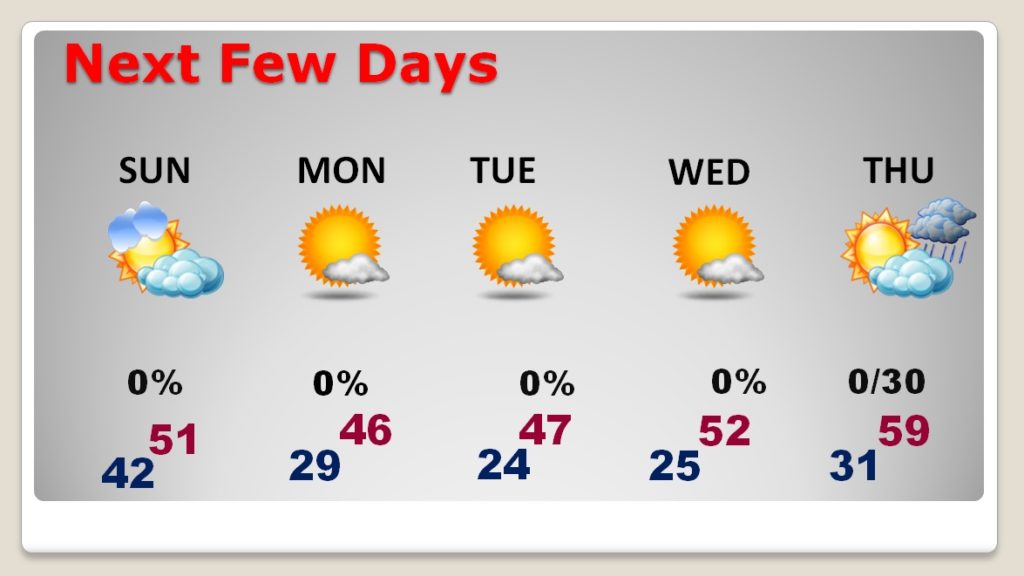
NEXT FEW DAYS: Sunday will be a blustery day. The high will struggle to pass 50. Northwest winds at 12 to 20 gusting to 25 will make it seem colder. We are headed to the 20’s for lows at least three nights starting Sunday night. Coldest days will be MLK Day Monday and Tuesday with highs only in the 40’s. Next Chance of rain will come Thursday night into Friday as the next Front approaches.
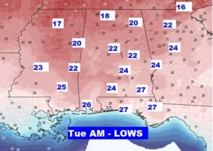
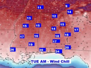
Coldest mornings will be Tuesday and Wednesday morning. Here’s a sample of some expected Tuesday morning lows and the potential wind chill.
—
I’ll have another Blog update for you in the morning. Have a great weekend.
-Rich