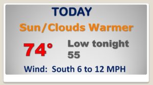
Good morning! If you liked yesterday, you’ll love today. This week starts with a nice warming trend. The shower risk holds off until Tuesday afternoon & night. Looks like an active week ahead.
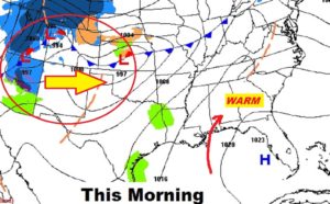
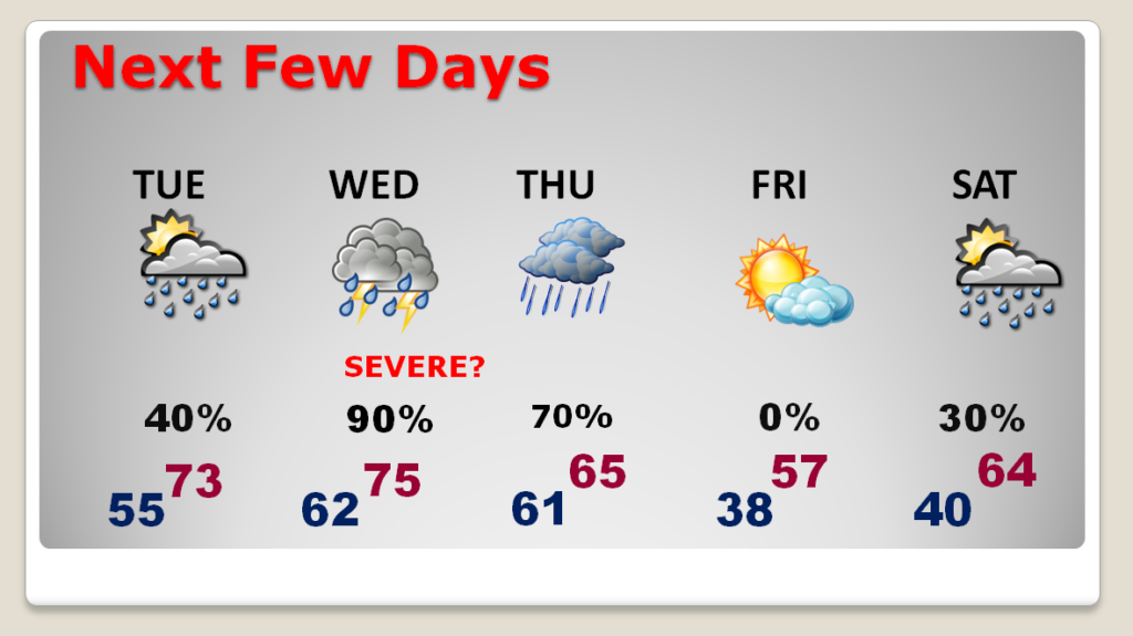
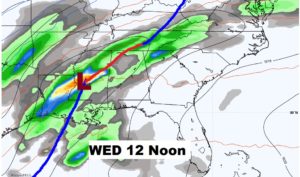
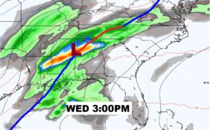
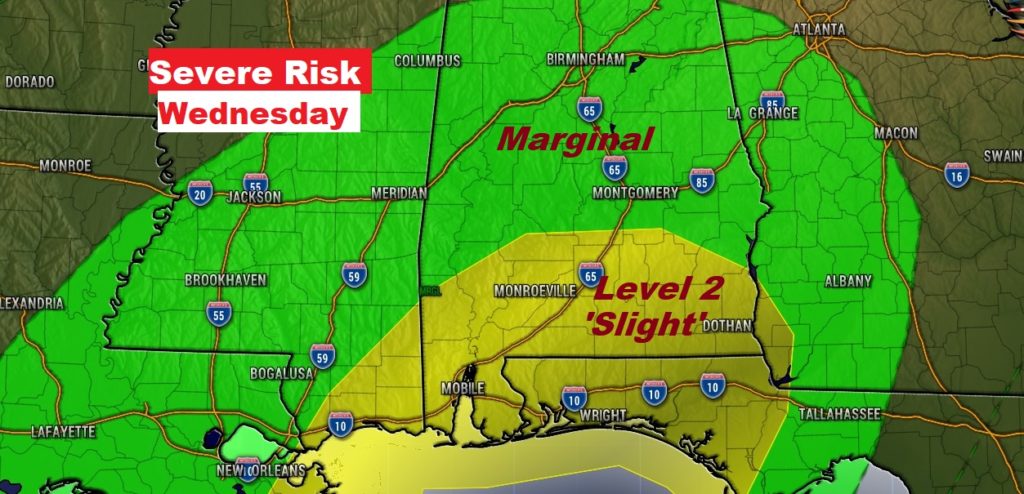
All eyes on Wednesday’s Severe Weather Risk. Look’s like the threat will be strongest from Wednesday afternoon into Wednesday night. I have new model data to share, and the latest map from the Storm Prediction Center.
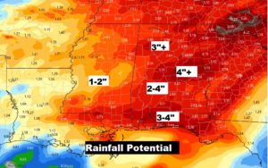
Plus, rainfall amounts could be significant this week. I’ll show you how much, and when the rain will exit.
Expect a sensational start to the week today with more sun than clouds. The Warming trend continues. Beautiful early February day.
Spotty showers Tuesday. Better chance Tuesday night. Showers and storm Wednesday, possibly severe.
It appears the strongest Severe Threat would be Wednesday afternoon into Wednesday night.
Right now south Alabama has the strongest threat…a Level 2 slight risk south of a Camden, Ramer, Clio line. Severe thunderstorms with damaging wind gusts, are possible. Tornadoes can’t be ruled out.
Rainfall amounts in the week ahead could be significant.