Early morning update and video:
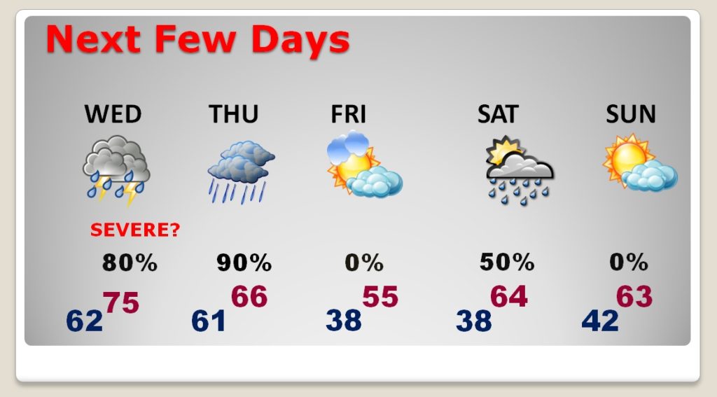
Good morning! There is much to talk about. A significant, slow-moving, storm system will effect the state Today through Thursday. The main event involves a Severe Weather Threat Wednesday and Wednesday night. It includes a damaging wind threat, and the possibility of tornadoes. Plus, rainfall amounts will be locally heavy Wednesday through Thursday. Localized flooding is possible. I have an updated Severe Weather threat level, an update on the slower timeline, and the rainfall potential. What about the weekend? I have an update.
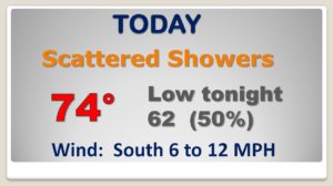
The slow moving storm system edges eastward today. Just some scattered showers for us today and tonight. Nothing heavy. No severe weather.
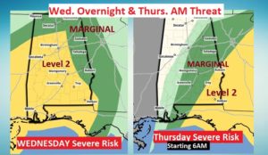
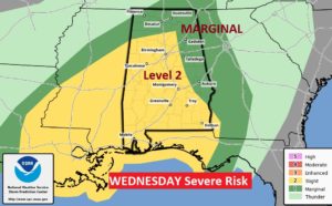
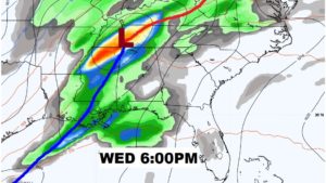
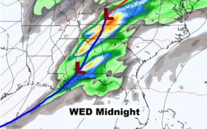
That higher risk Level 2 Severe Weather Risk has been expanded to include much of the state. Threat of damaging wind gusts and possible tornadoes, Wednesday afternoon and Wednesday night.
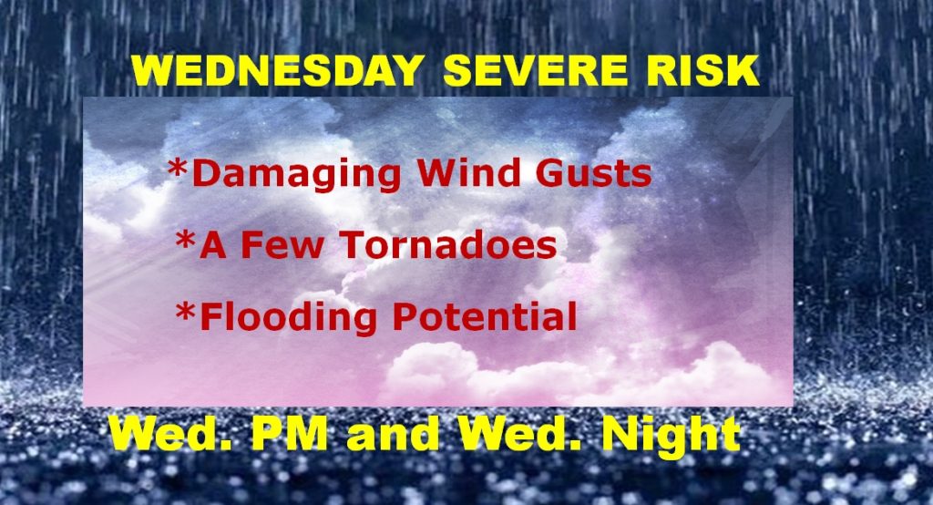
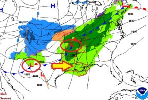
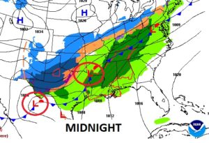
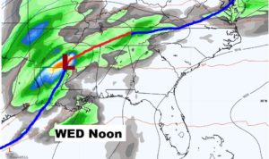
Waves of Low pressure will move northeast along the approaching Front Wednesday and Wednesday night. Periods of locally heavy rain with embedded strong to severe storms. Tornadoes are possible, along with flooding.
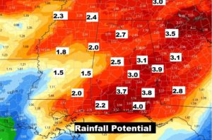
Flooding is a potential in some spots between now and Thursday. Most places will see 2-4″. Some amounts over 4″ are easily possible.
Wet and stormy through Thursday. Windy & Colder Friday. Risk of showers Saturday. NICE day Sunday…