Good morning.. Alabama is under assault. Parts of our state have experienced more flooding rainfall in the past 24 hours. Rivers are near or above flood stage. And, the projected rainfall, in the next 7 days, is rather disturbing. Added to that, we are facing another overnight Severe Weather Threat Wednesday night, just like last week. Will we see any breaks over the next few days? We’ll look ahead through the rest of this week and through the weekend. I have an update on the 7 day projected rainfall.
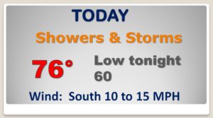
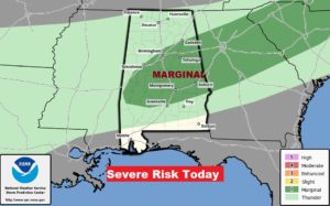
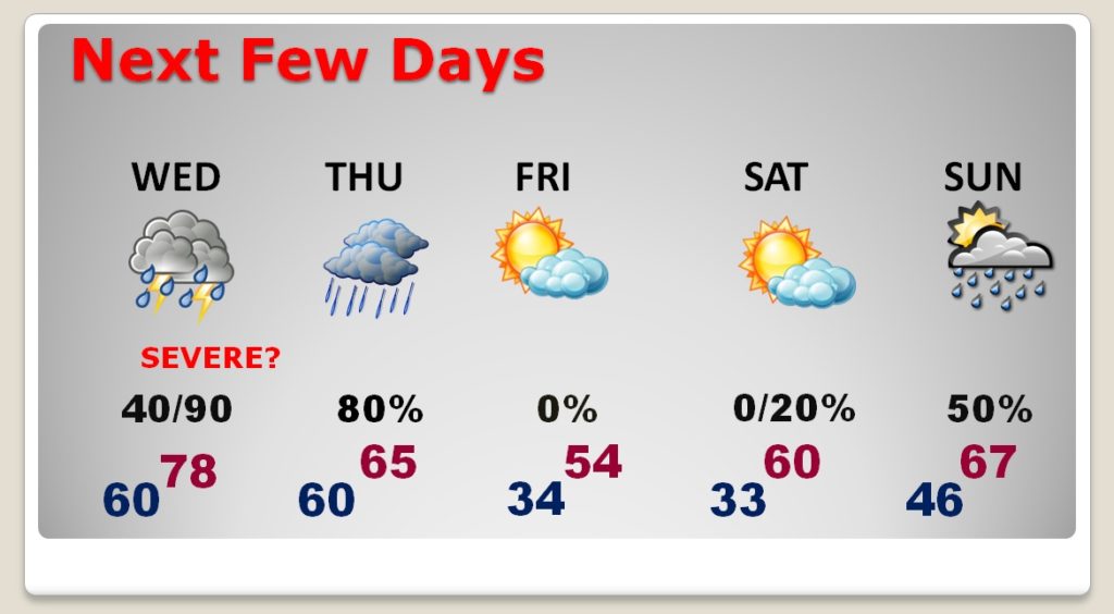
That front moving through the state today will touch off another round of showers and storms. It’s possible a couple storms could have some strong wind gusts. Marginal Severe Risk today…
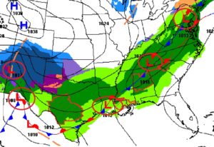
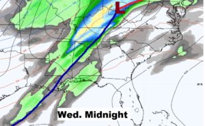
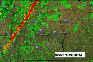
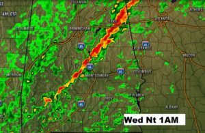
WEDNESDAY NIGHT Severe Weather Risk. Once again, unfortunately, it will be another overnight severe risk like last Wednesday night, with damaging winds and threat of an isolated tornado or two.
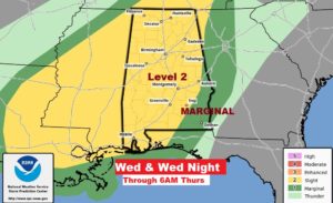
Another potent Wednesday night storm system with the threat of severe weather in the overnight hours. Most of the activity will be along a strong line of storms late Wednesday night with damaging winds and threat of an isolated tornado or two.
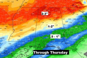
Additional rain through Thursday…heaviest in northwest Alabama. South and SE Alabama, perhaps under 1″.
Rain ends by mid-day Thursday with falling temperatures. We’ll be in the low 30’s by Friday and Saturday morning. Chilly Friday. Not quite as chilly Saturday. More rain Sunday & Monday.
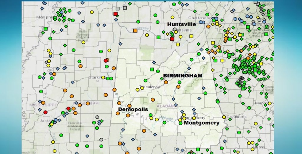
This is the river flooding status map. Yellow shows rivers near flood stage. Orange and red are rivers above flood stage.
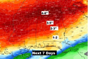
This map is disturbing. Here’s the rainfall potential next 7 days. The ground in north Alabama simply can’t handle any more rain.