
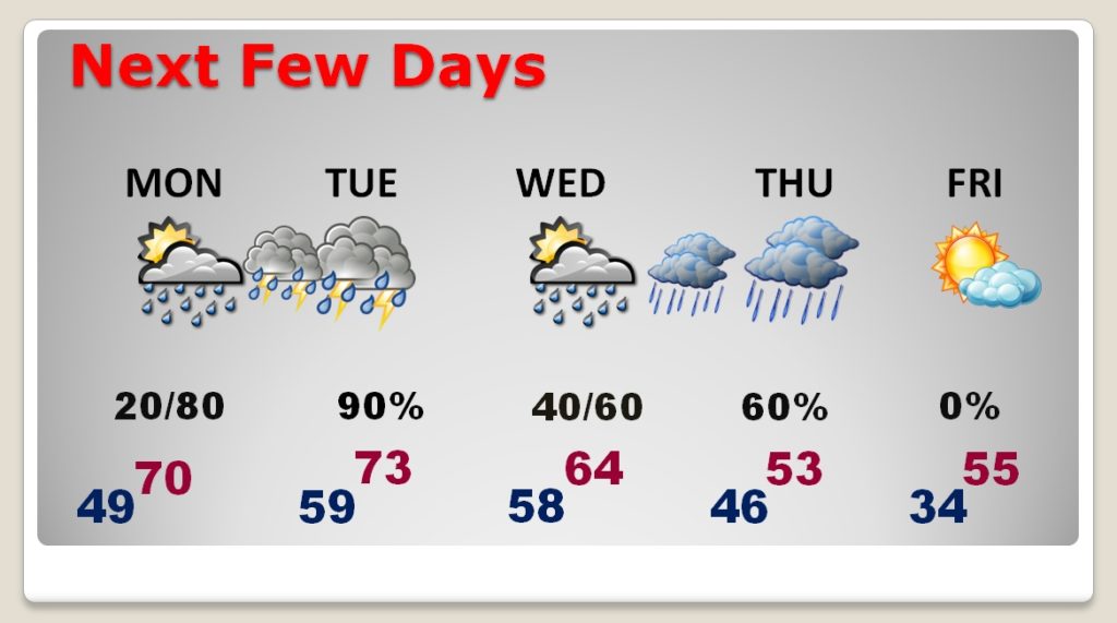
There are new wrinkles in today’s forecast, and new wrinkles in the forecast for the week ahead. I have raised the rain chances today, and I have lowered the expectation on today’s high temperature.
It looks like an active weather week ahead. We’ll be dealing with the main storm system, and front, Tuesday and Tuesday night. But, there will be a secondary system, which will bring another surge of moisture and a COLD rain to the state Thursday. Late week will be sharply colder. I have adjusted the rain chances, and temperatures on the graphic below.
TODAY & TONIGHT: Good chance of on and off showers anytime today into tonight. High temperature will be held down to the upper 50’s with the clouds and showers. Low tonight 49.
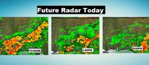
Future Radar gives you an idea of how widespread the showers across the state today.
NEXT FEW DAYS: Most of President’s Day should be dry. It will be a warmer day. Showers and storms become likely Monday night, Tuesday, and through Tuesday night, as a cold front cuts across the state. Right now, any potential severe weather threat appears to be very low. We may get a little break in the rain, briefly, on Wednesday, before more rain Wednesday night into Thursday. Looks like a cold, miserable rain Thursday, in the colder air behind the front. Right now, I do not anticipate any winter weather issues in our area. I’ll leave it at that. Not sure about other parts of the state.
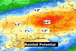
HOW MUCH RAIN?: Wet times ahead, once again this week. Total rainfall, through late week could total 2-4” in spots.
—
Thank you again for all your support, following the loss of my dog Bailey. Your kind messages are helping me get through my sense of loss. As you know, if you’ve gone through this before, it is a difficult work in progress.
- –
I will have a video update for you first thing tomorrow morning. It should be online by about 4:45AM. Have a nice day!
–Rich