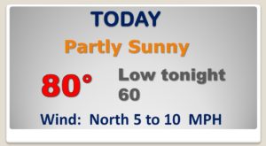
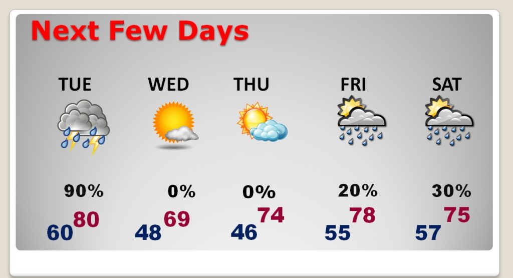
Good Morning! Today will be the eighth day with highs in the 80’s. But, a big change is on the way. An approaching storm system will bring a risk of strong to severe storms to Alabama on Tuesday, perhaps beginning in the morning and through Mid afternoon. Tornadoes are also possible. But, much cooler air will follow the storm system. On this video I’ll update you on the severe weather potential impacts, and timeline. I’ll walk you through the week ahead.
QUIET today. Warm again. High 80 or above… Look at that storm system in the southern Plains. That’s our future tomorrow.
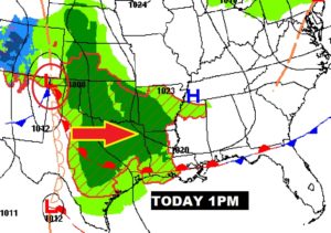
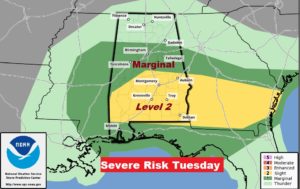
Prime set-up for severe weather tomorrow. Storm system near Jackson, MS., lifting a warm front northward into Alabama.
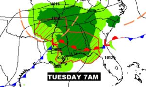
It now appears the severe weather risk will reach as far north as the Clanton area. Most of the southern half of the state is in the Level 2 risk. Damaging wind guts to 60 mph. Risk of tornadoes, too. Action could begin early. Main risk window from about 10AM to 3PM.
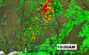
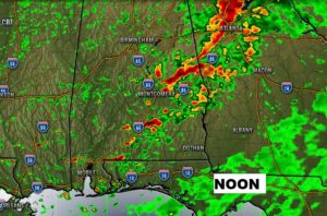
Couple of late morning Future Radar snapshot. Very active, particularly from 10 to 2 locally.
Much cooler behind the storm system. 40’s Wednesday & Thursday mornings. Warmer late week.
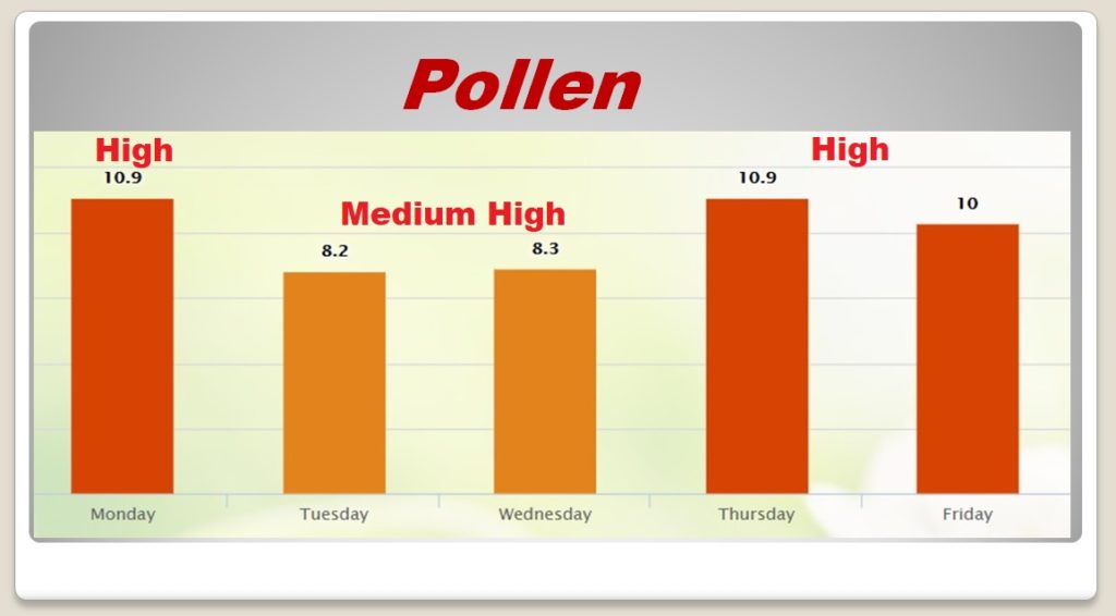
Another BAD week for pollen…