
It’s a chilly start on this Saturday morning, but we have a great day ahead. Look for a mostly sunny, comfortable day, with a nice afternoon warm-up. Call it …the calm before the storm. Because we have an ominous storm system looming for Easter Sunday and Sunday night.
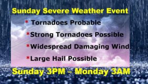
This will not be a routine Severe Weather Event. The threat Level is unusually high. A few strong long-lived tornadoes are not out of the question. Widespread wind damage, and large hail is also possible. Details below.
TODAY: Cool start, but a nice day. Abundant sunshine. Comfortable. High 77. Becoming cloudy tonight. Chance of showers/storms after about 2AM. Low 57.
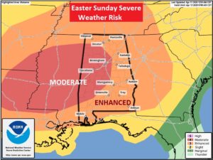
SUNDAY SEVERE THREAT: The Storm Prediction Center has maintained a significant risk level for all of Alabama on Easter Sunday. All of the state in in at least an Enhanced Risk. Level 3 out of 5. Much of the western half of the state is under a MODERATE Risk. Level 4 of 5. The Moderate Risk area is generally west of I-65. SPC says: “Strong Long-tracked tornadoes, potentially widespread damaging winds, and large hail are possible” A strong Tornado would be EF-2 or higher.
The most likely timeline would be from about 3PM west to 3AM East.
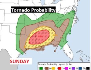
Tornado Probabilities of 10% probability of within 25 miles of any point, cover most of Alabama. The western counties, in the moderate risk area, have a rather disturbing 15% chance.
Many uncertainties remain on how the severe weather threat will evolve. For instance, there is one scenario which would allow for afternoon super-cell storms to potentially develop. This would be the most dangerous time for strong tornadoes IF this scenario plays out. We’ll know tomorrow morning.
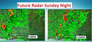
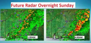
Here are a few Future Radar snapshots starting at 7PM Sunday night until 4AM Monday morning. The final band or line of storms will feature widespread wind damage and a few tornadoes embedded in the line.
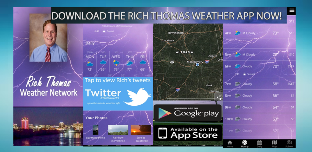
BE READY FOR SEVERE WEATHER: Have a plan of action for your family. Be ready to go to your safe place. Wear shoes. If you have helmets…wear them during a warning. You need at least two reliable ways to get a warning. Our weather app could be one. A Weather Radio is a very reliable way to get a warning. It will wake you up when a warning is issued. Do not rely on hearing a weather siren. They are only designed to be heard by those who are outside, and, they sometimes malfunction. Stay in your safe place during a warning. You can watch our LIVE stream on our weather app. Download the App by going to the app store and search Rich Thomas Weather.
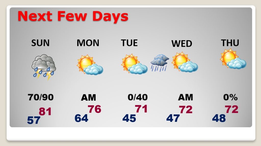
NEXT FEW DAYS: After the storms Sunday, Monday should be a pretty nice day. Much cooler air. Lows in the 40’s Tuesday, Wednesday and Thursday mornings. Highs in the lower 70’s Chance of showers late Tuesday night and Wednesday morning.
– -.
I will continue to update you on this developing Major Easter Sunday Severe Weather Event. Stay weather aware. I will have another Blog update tomorrow morning. I’ll have additional updates this afternoon as needed. Follow me on Twitter: @RichThomasWX. Stay safe and well.
-Rich