4:00 UPDATE:
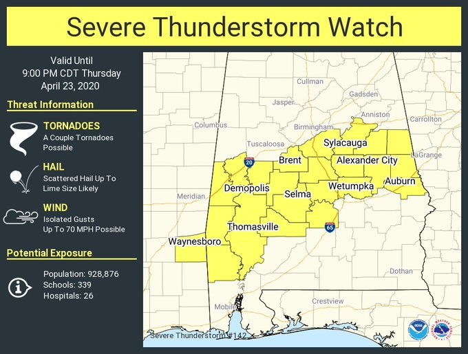
Severe thunderstorm watch issued for much of central Alabama until 9PM. Hail up to Lime size.. Damaging winds to 70 mph. Can’t rule out a tornado or two.
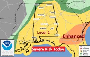
The Severe Weather Risk for has been downgraded slightly to a Level 2 “Slight Risk” Thunderstorms will develop. Some could become severe weather damaging winds to 60 mph, large hail and some tornadoes. Even though the threat has decreased one notch, don’t let your guard down.
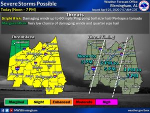
The main time window is from about Noon far west to 7PM far East. Here’s the updated NWS time-line graphic:
EARLY MORNING UPDATE:
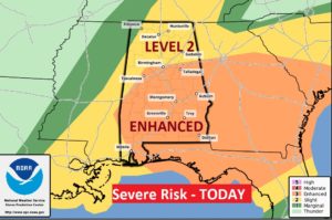
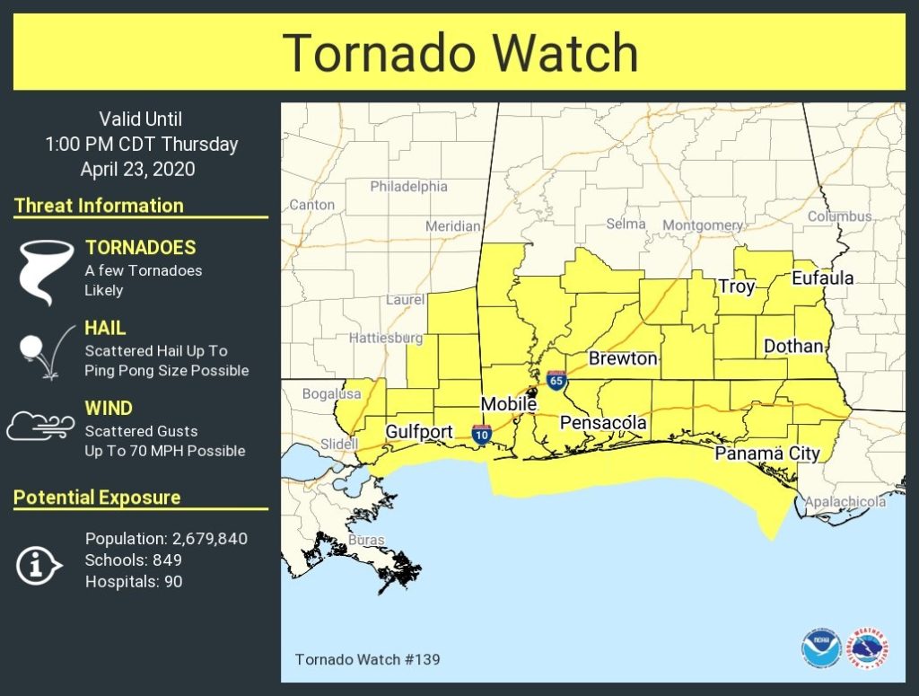
Alabama will once again be in the severe weather mode today. We are in an ENHANCED risk. Level 3 out of 5. All modes of severe weather are possible, including damaging winds, and tornadoes. The scenario is complicated. It involves two rounds of severe weather. One this morning and another this afternoon. The afternoon round is highly dependent on how the morning round plays out. The greatest tornado risk will play out across the area in round two. I’ll bring you up to date with the details on this video and we’ll look ahead to calmer weather this weekend. Stay weather aware today. Make sure you have our weather app on your phone. Already this morning, much of South Alabama is under a Tornado Watch.
ENHANCED severe risk today. All modes of severe weather possible inducing damaging winds, large hail and tornadoes.
Already ALL of South Alabama is under a tornado watch until 1PM.
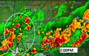
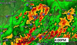
Couple of afternoon snapshots of future radar showing how individual storms develop in a ripe enviroment and they coukd easily become tornadic.
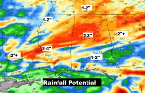
Locally heavy rainfall.
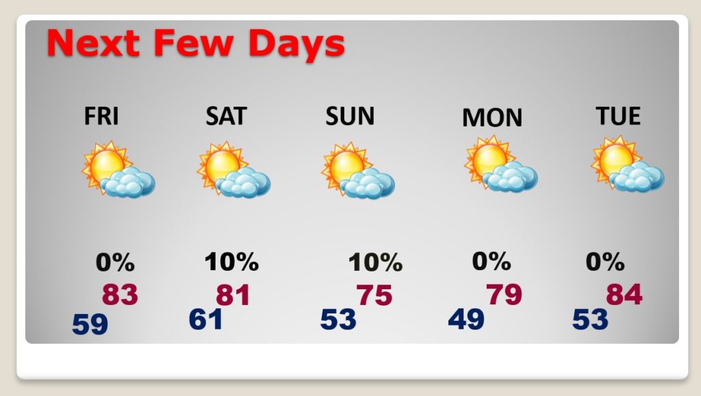
Nice weather returns for Friday and a period of quiet days will follow.